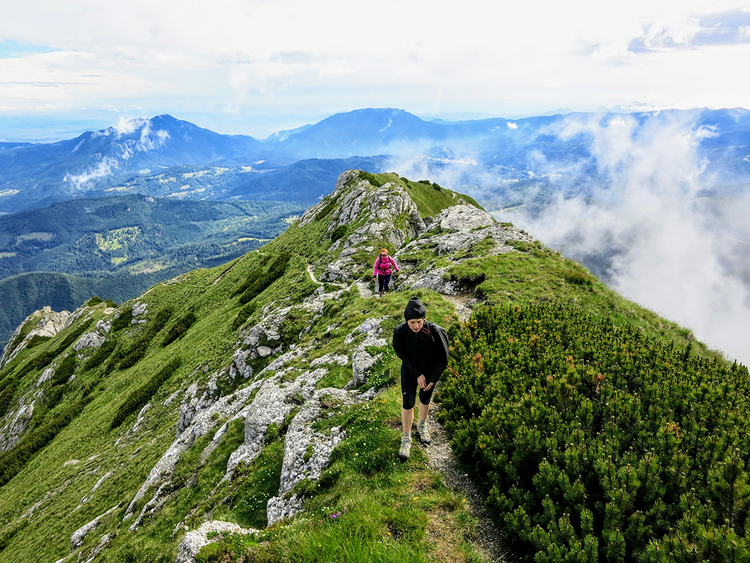
La Lanțuri – scrambling in Piatra Craiului
La Lanțuri is a technical and spectacular trail that will take you in about 5 hours from Plaiul Foii to Vârful La Om – the summit of the Piatra Craiului Mountains.
“La Lanțuri” is Romanian for “At the chains”. The trail got its name from the many steep and exposed portions where you have to climb holding on to the chains fixed in the rock.
It starts at Cabana Plaiul Foii, on the western side of the Piatra Craiului Mountains, 12 km from the town of Zărnești.
Some say it’s the hardest, most technical marked trail in Romania.
If you decide to go on this trail, you must be in good shape and have enough experience, for both hiking and scrambling. Keep in mind that once you reach the Piatra Craiului ridge, there won’t be any easy way down.
There are several ways to continue your hike from Vârful La Om
You can scramble on the Piatra Craiului ridge all the way to Varful Padina Popii and from there descend back to Plaiul Foii.
As an alternative, from Vârful La Om you quickly get off the ridge towards the Grind refuge (1620 m) and then descend towards the town Zarnesti.
We described both of these options at the end of the article.
Be aware that you will not encounter any water source on the trail and the hike is quite strenuous, so we recommend starting the hike with at least 3-4 liters of water per person.
Quick info about La Lanțuri
- Starting point: Cabana Plaiul Foii (850 m)
- Destination: Vârful La Om (2238 m)
- Seasonality: only in good weather, forbidden during winter
- Duration: 9-12 hours (5 hours to go up and 4-7 hours to descend, depending on the route)
- Length: 13-17 km (depending on the route you choose for descent)
- Difficulty: high (scrambling involved)
- Equipment: good hiking boots, helmet, and gloves (recommended)
- Closest accommodation unit to the start of the trail: Cabana Plaiul Foii
- The closest town to the start of the trail: Zarnesti (12 km)
- Distance from Bucharest: 190 km (3-4 h) by car
- Parking: free parking on the side of the road
Equipment
- shoes with good adherence to the rock, preferably boots
- 3-4 liters of water
- helmet
- gloves
- 3 layers of clothes
- sunscreen
Weather
Only attempt this hike during summer, on good weather. Check the forecast here.
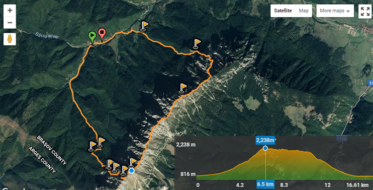
GPS track and altitude profile
The track below shows the circuit from Plaiul Foii to Vârful La Om via La Lanțuri from where it continues on the Piatra Craiului ridge toward Vârful Padina Popii and then descends back to Plaiul Foii via Refugiul Diana.
La Lanțuri – trail markings
- Total duration: ~5 h
- Checkpoints: Cabana Plaiul Foii – Spirlea refuge – Zaplaz – La Lanțuri – Vârful La Om
Red stripe: Cabana Plaiul Foii (850 m) – Spirlea refuge (1440m) – La Zaplaz (1640 m) – Saua Grindului saddle (2195 m) 4.5 h
Red dot: Saua Grindului saddle – Saua Grindului refuge – Vârful La Om (2238 m) 20 minutes
The start of the trail – Cabana Plaiul Foii (850 m)
The trail starts near Cabana Plaiul Foii, 14 km away from Zarnesti train station.
The road to Cabana Plaiul Foii is paved and you can park your car on the side of the road, for free.
- Click here to navigate to the start of the trail with Google Maps.
Cabana Plaiul Foii – Spirlea refuge (1440 m) – La Zaplaz (1640 m)
- Duration: 2 hours
From Cabana Plaiul Foii walk for 200 meters until you reach an intersection, turn left and walk along the Barsa Tamasului river and start following the red stripe markings on the trees towards the Spirlea refuge.
After 2 km, the trail starts to get steeper while you start walking through Spirlea Valley.
You should reach the Spirlea refuge in 1.5 hours from the start of the trail.
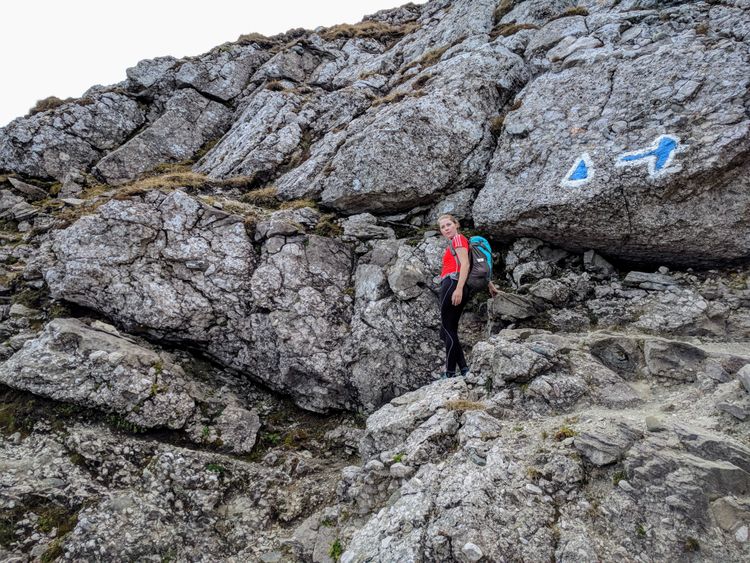
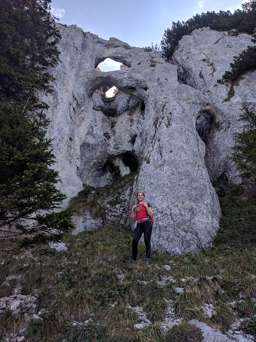
From the Spirlea refuge continue on red stripe markings. In about 30 minutes you should reach La Zaplaz – a place where the water and wind erosion have sculped the rock and created some natural arches.
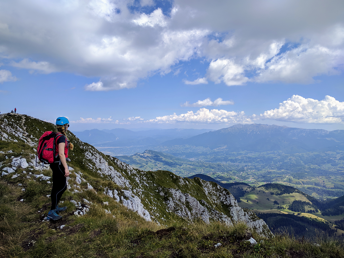
La Zaplaz (1640 m) is an interesting rock formation and a great place to take a photo. The trail up to here is also suitable for beginners.
The hard part starts from hereon.
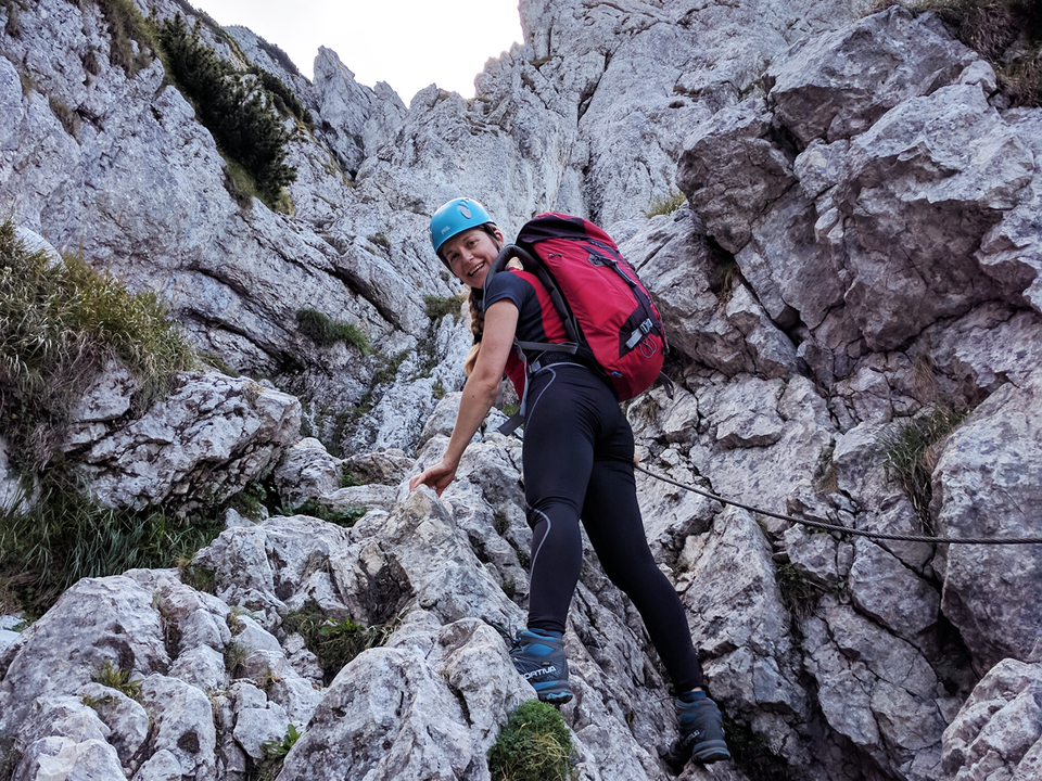
The technical part – La Lanțuri towards Vârful La Om
- Duration: 3 hours
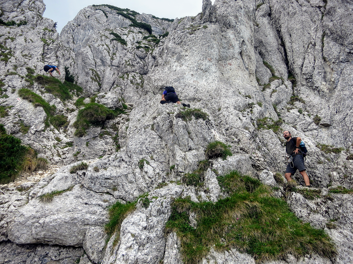
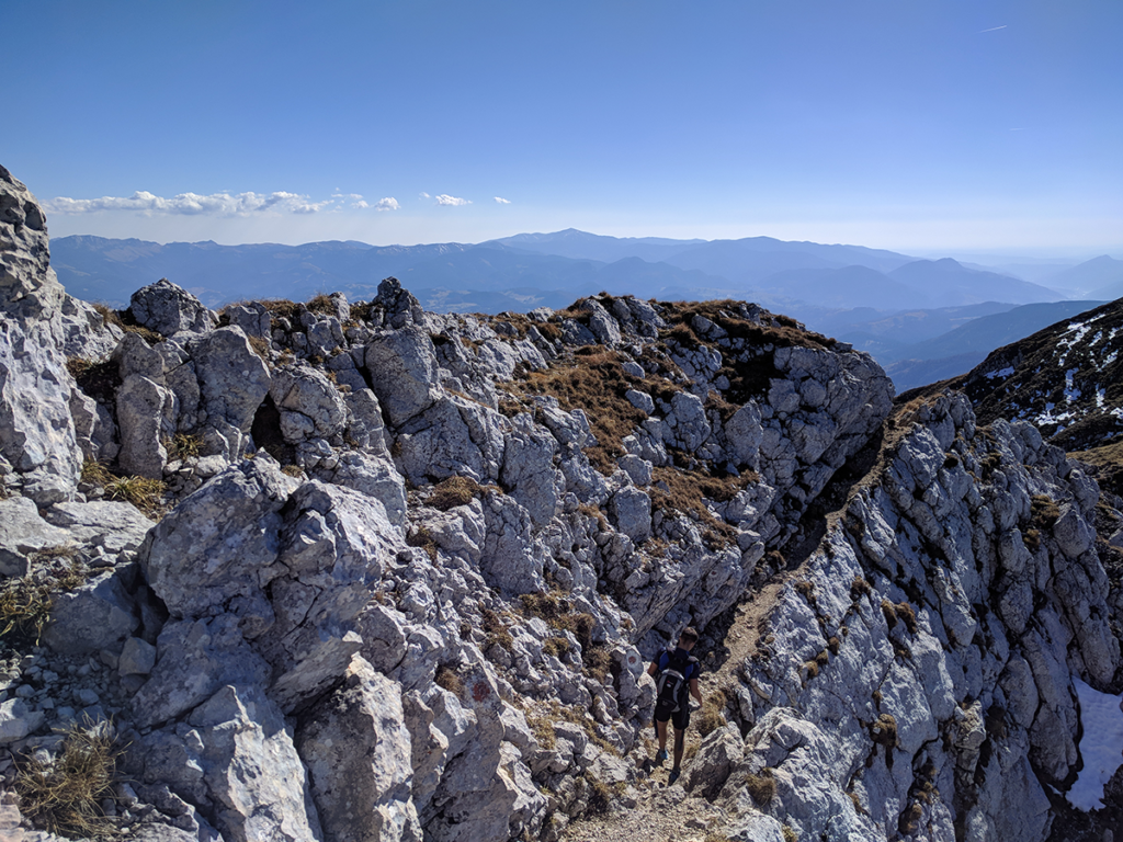
The part of the trail that takes you from La Zaplaz to the Piatra Craiului ridge, in Saua Grindului saddle, is called La Lanțuri.
From La Zaplaz, continue to the left, going up and following the red stripe markings.
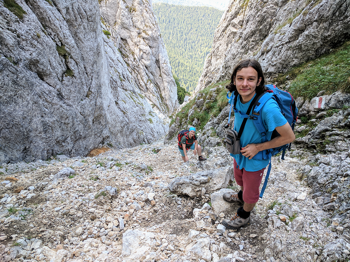
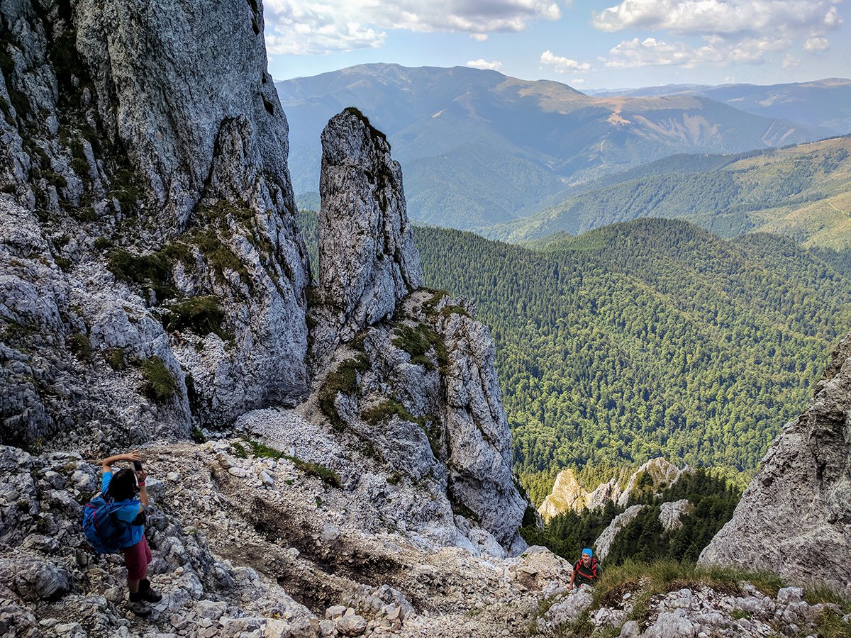
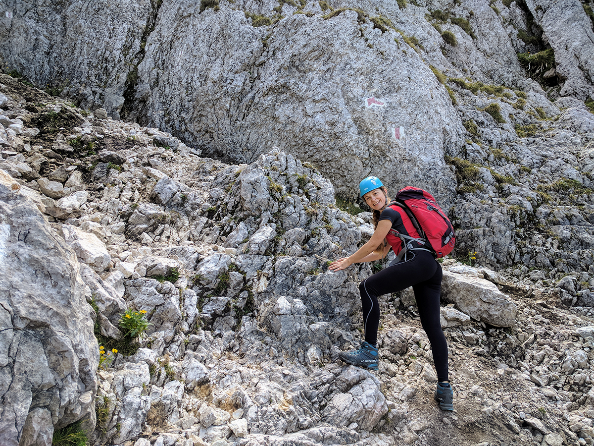
In order to get to the ridge, from now on you will have to scramble.
The climb is not very difficult since on the most exposed segments there are chains you can hold on to, but it can be terrifying if you are afraid of heights.
Very important: step carefully in order not to move the rocks off of the trail because they may hit the persons below you.
For the same reason, it’s recommended to wear a helmet, especially during the weekend, when it gets crowded.
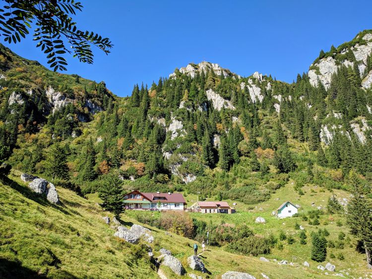
The refuge in Saua Grindului (2206 m) and Vârful La Om (2238 m)
From La Zaplaz you should get on the Piatra Craiului ridge, in the Saua Grindului saddle (2195 m), after 2-3 hours of scrambling.
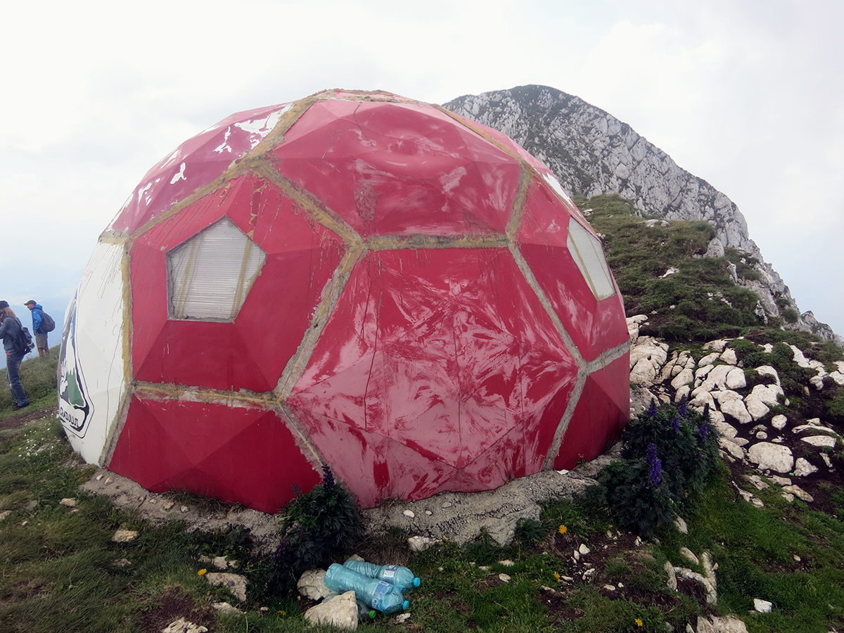
Once on the ridge, start following the red dot markings towards the north (left) and soon you will get to the Saua Grindului refuge (2206 m).
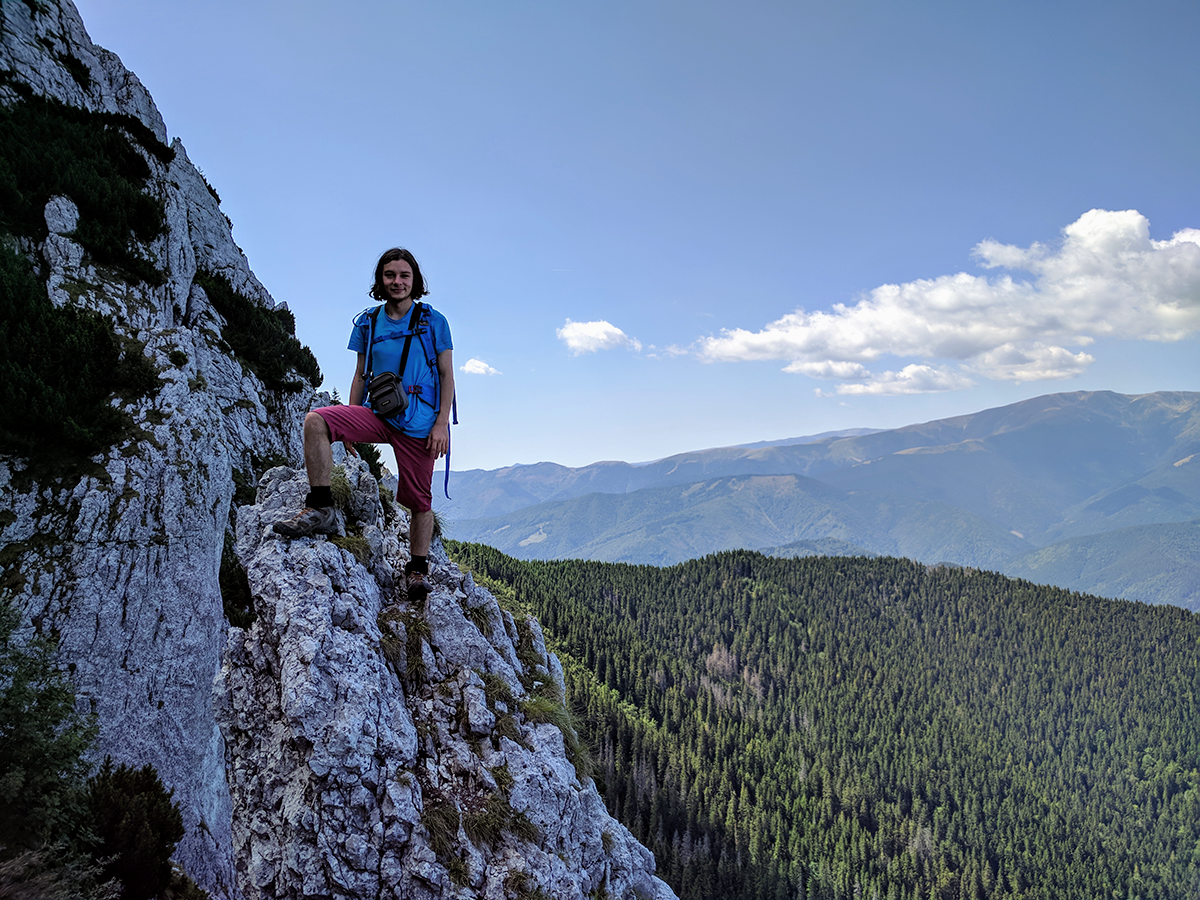
From the Șaua Grindului refuge continue on the red dot markings and in a few minutes you will reach the highest peak of Piatra Craiului mountains – Vârful La Om (2238 m), also known as Piscul Baciului (The Shepherd’s Peak).
Descending from the Piatra Craiului ridge
The fastest way back to Plaiul Foii
- Duration: 4 hours
The fastest way to get back at Plaiul Foii would be to descend on the same way you climbed up, via La Lanțuri path. It should take around 4 hours.
The hardest and most rewarding way back to Plaiul Foii
- Duration: 7 hours
Red stripe: Vârful La Om (2238 m) – Vârful Ascutit (2100 m) – Vârful Padina Popii: 4 hours
Blue triangle: Vârful Padina Popii – Refugiul Diana 1 hour
Yellow triangle: Refugiul Diana – Cabana Plaiul Foii 2 hours
A 7-hour long, difficult, but extremely rewarding way to get back to Plaiul Foii from Vârful La Om is to scramble your way on the northern Piatra Craiului ridge until you reach Vârful Padina Popii.
This is the circuit that appears on the wikiloc track above.
It will take at least 7 hours, so plan accordingly.
Directions
From Vârful La Om, follow the red dot markings on the ridge, towards the north.
In about 3 hours you will reach Vârful Ascuțit, where you will find a bivouac refuge.
From Vârful Ascuțit continue on the ridge, on the red dot markings, and in less than 1 hour you should get to the signpost near the Vârful Padina Popii peak.
From Padina Popii continue on the blue triangle markings towards the Diana refuge and from there on yellow triangle towards Plaiul Foii.
It will be a steep descent, with a portion of scree, which will make walking even harder.
The fastest way down from the ridge
- Duration: 6 hours
Red stripe: Vârful La Om (2238 m) – Grind refuge (1620 m) – La Table 2-3 hours, 3 km
Red cross: La Table – Saua Joaca – Casa Folea 1 hour, 3 km
Red stripe: Casa Folea – Fantana lui Botorog 1.5 hours, 4.5 km
In case of bad weather, you may need to get down fast from the Piatra Craiului ridge.
The fastest way to do this is to descend on the western side, towards the Grind refuge, from where you can then head towards the town of Zarnesti.
From Vârful la Om to the Grind refuge, it will be a steep 2-hour descent, but without much scrambling, if any.
The whole trip is around 11 km long and it will take around 5-6 hours.
Directions
From Vârful La Om, follow the red stripe markings towards Refugiul Grind and then La Table.
In order to get to Zarnesti, from the Grind refuge continue towards La Table on the red stripe markings.
From La Table head towards Saua Joaca by following the red stripe and red cross markings.
From Saua Joaca follow the red cross markings until you reach the signpost near Casa Folea and from there start following the red stripe markings towards Fantana lui Botorog.
More photos from the La Lanțuri trail