Brasov, Romania: Tâmpa and Postăvaru day-hike
We walked to the top of Tâmpa (960 m), the mountain in the center of Brasov and then continued our hike into the wilderness all the way to Postăvarul Peak (1799 m).
What is Mount Tâmpa?
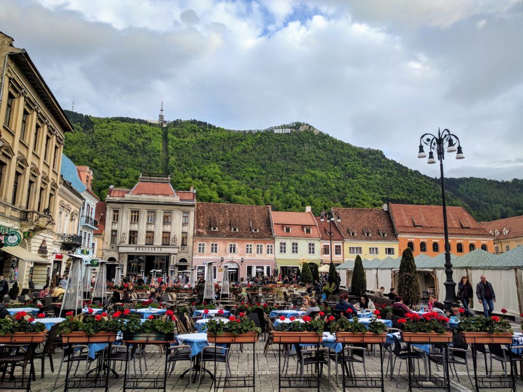
If you are in Brasov, most likely you have already noticed the Hollywood-style letters on the hill that raises from the center of the city.
That hill is actually a mountain, 960 meters high. It is called Tâmpa and is part of the Postavarul Massif. It is a natural reserve, home to several species of protected plants and animals.
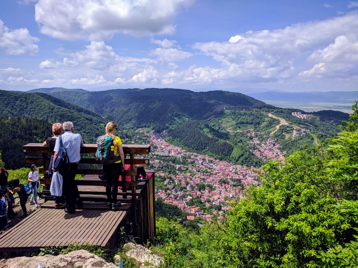
Brasov was built around Mount Tâmpa, which raises more than 300 meters above the city. The views from the top are amazing.
Getting to the top of Tâmpa
From the top of Mount Tâmpa you will have some stunning views over the Old Town of Brasov.
You can reach the top of Tâmpa either by cable car, or by hiking one of the several walking trails that start in different parts of Brasov.
The trails are well marked and less than 3 km long. It takes around 1 hour and 30 minutes to hike from Brasov to the top of Tâmpa and even less to descend.
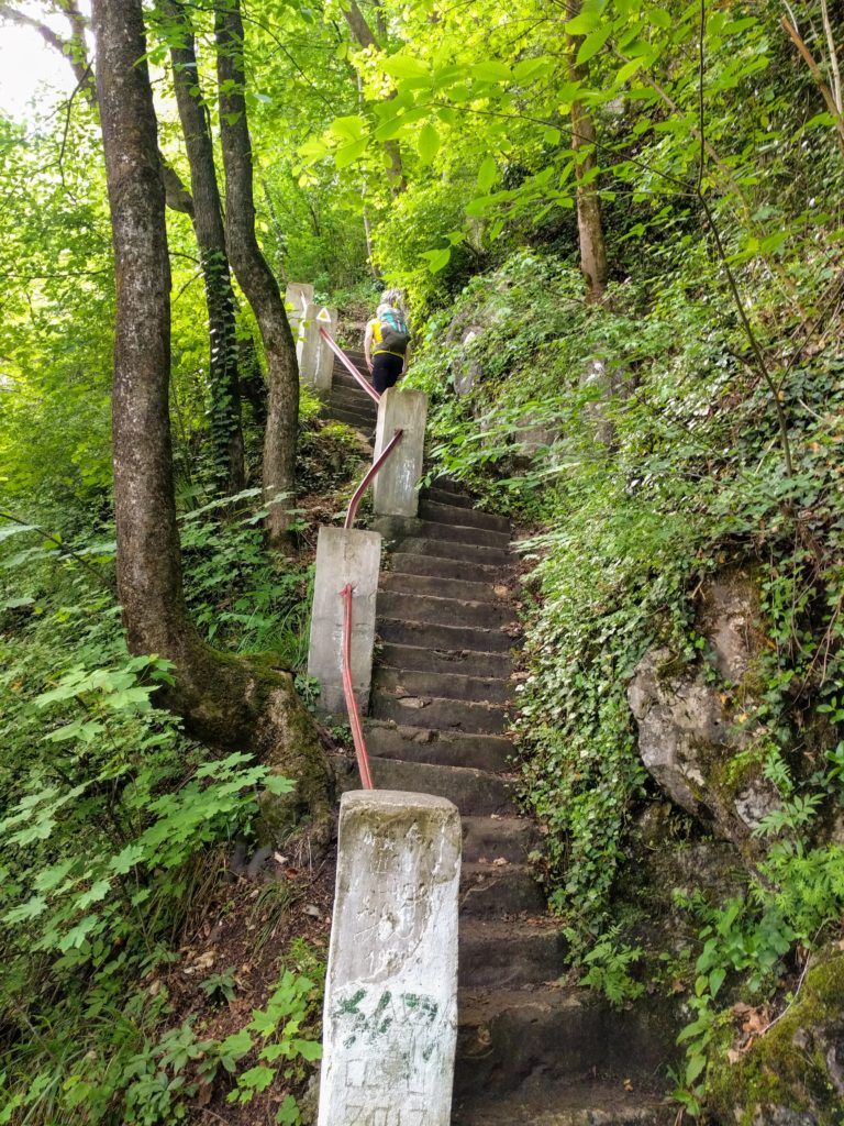
Note: wear proper hiking shoes if you want to walk on the trails of Mount Tâmpa. The paths are rocky, muddy and slippery.
The cable car from Brașov to Tâmpa
The cable car is functioning between 9:30 to 16:30, from Tuesday to Sunday and costs around 10 lei for a one-way trip.
The cable car will leave you close to the giant letters that form the word BRASOV.
There is a nice viewpoint next to the letters, but if you walk for another 10 to 15 minutes you will reach the top of Tâmpa, where the panorama is much wider and, as a bonus, it’s usually less crowded.
Hiking from Brasov to Tâmpa
There are two popular hiking trails that go up Mount Tâmpa: The Serpentine Trail and The Gabony’s Steps trail. They are both of easy difficulty (considering you have proper hiking shoes) and around 2 to 3 km long. You will gain around 300 meters of elevation from the start of the trail to the top of Tâmpa.
The Serpentine Trail (Drumul Serpentinelor)
The Serpentine Trail is a winding and easy 2.7 km path, marked with red triangle, that starts near the cable car station in Brasov and takes you the top of Tâmpa in about 1.5 hours.
- Trailhead: Aleea Tiberiu Brediceanu 1, Brasov
- Markings: red triangle
- Length: 2.7 km
- Duration: 1.5 h
- Elevation gain: 300 meters
The Gabony’s Steps trail (Treptele lui Gabony)
The Gabony’s Steps trail is about 2 km long, marked with yellow triangle and slightly steeper and more rugged. At the beginning of the trail, you will have to climb some steps carved in the rock that were built by Gabony in 1831.
- Trailhead: Strada Constantin Dobrogeanu-Gherea 62, Brașov
- Markings: yellow triangle
- Length: 1.7 km
- Duration: 1.5 h
- Elevation gain: 300 meters
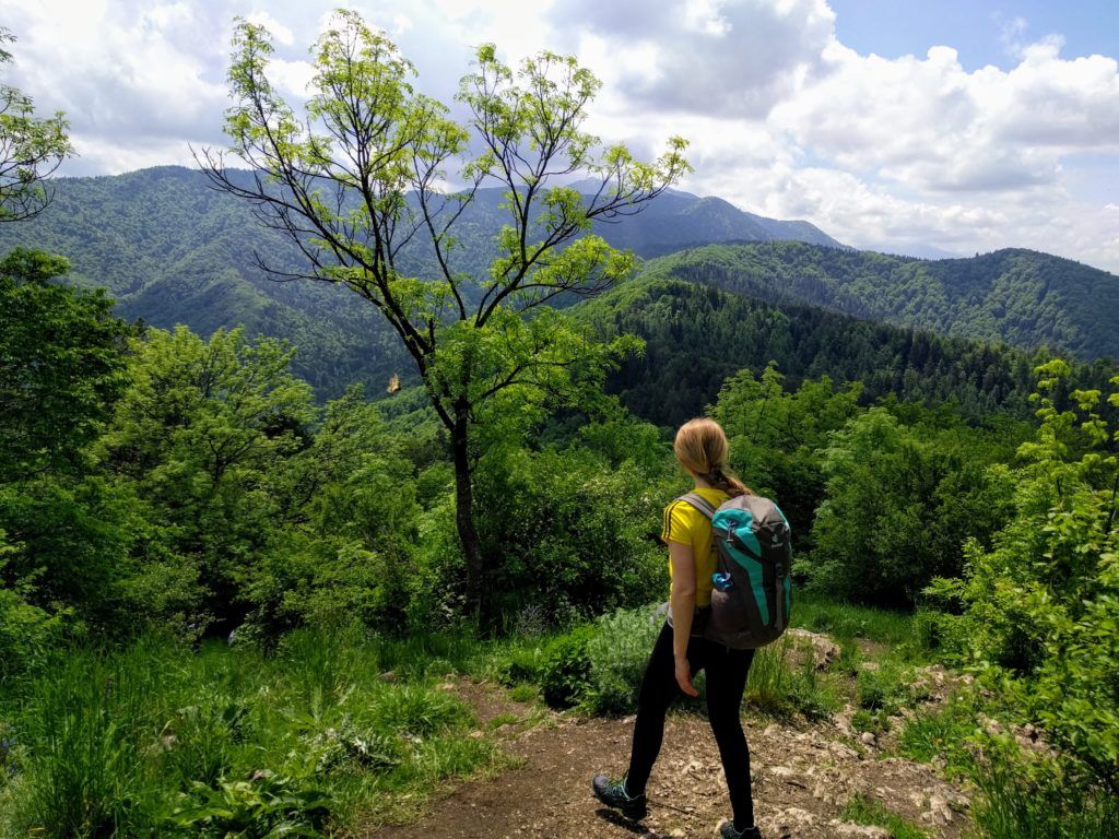
From Tâmpa to Postăvaru Peak (27 km, 8 hour)
We ascended to the top of Tâmpa by taking the Gabony’s Steps trail and then continued our hike all the way to the highest peak of the Postăvarul Massif: Varful Postavaru (1799 m).
From Postavaru Peak we descended back to Brasov on a different trail, that passed by the place called Pietrele lui Solomon, from where we continued our walk to the Old Town of Brasov through the historical Schei neighborhood.
Trail summary
- Trailhead: The Serpentine Trail or the Gabony’s Steps trail
- Duration: 8 hours
- Length: 27 km
- Difficulty: easy to moderate
- Elevation gain: 1570
- Elevation loss: 1570
- Highest point: Postavaru Peak (1799 m)
- Seasonality: all year
- Equipment: proper hiking shoes, water
Trail markings
- Brasov to Tâmpa via Drumul Serpentinelor (The Serpentine Road): red triangle, 1.5 h, 2.7 km
or
Brasov to Tâmpa via Treptele lui Gabony (Gabony’s Steps): yellow triangle, 1.5 h, 2.7 km - Tâmpa to Cabana Postavaru: blue stripe, 3.5 h, 10.5 km
- Cabana Postavaru to Postavaru Peak: blue stripe, 0.5 h, 2 km
- Decending from Postavaru Peak to Pietrele lui Solomon: blue stripe then yellow stripe 3 h, 10 km
- Pietrele lui Solomon to Piata Sfatului: asphalt road, 3.5 km
Trail Description
Ascend to the top of Mount Tâmpa by taking either The Gabony’s Steps or Serpentinelor trails.
Once you get near the letters that form the word BRASOV, where the Serpentine Trail and the Gabony’s Steps trail intersect, you will notice a signpost that points towards the top of Tâmpa and says you can reach Postavarul Peak in 4.5 hours if you follow the trail marked with blue stripe.
From the signpost, continue to ascend by following the yellow triangle (or blue stripe markings) and you will soon reach the top of Tâmpa.
Enjoy the views from the top over the Old Town of Brasov and then descend for about 15 minutes by following the blue stripe markings to Saua Tampei saddle (848 m), where you will find a signpost from where you will have to follow the blue stripe markings and you should reach Cabana Postavarul chalet in 3.5 hours and Postavarul Peak in 4 hours.
The path – all the way to Cabana Postavarul – is wide and not very steep, perfect for mountain biking. It’s popular among bikers since they can take the cable car all the way to near Postavarul Peak and then rapidly descend through the forest.
Cabana Postavaru
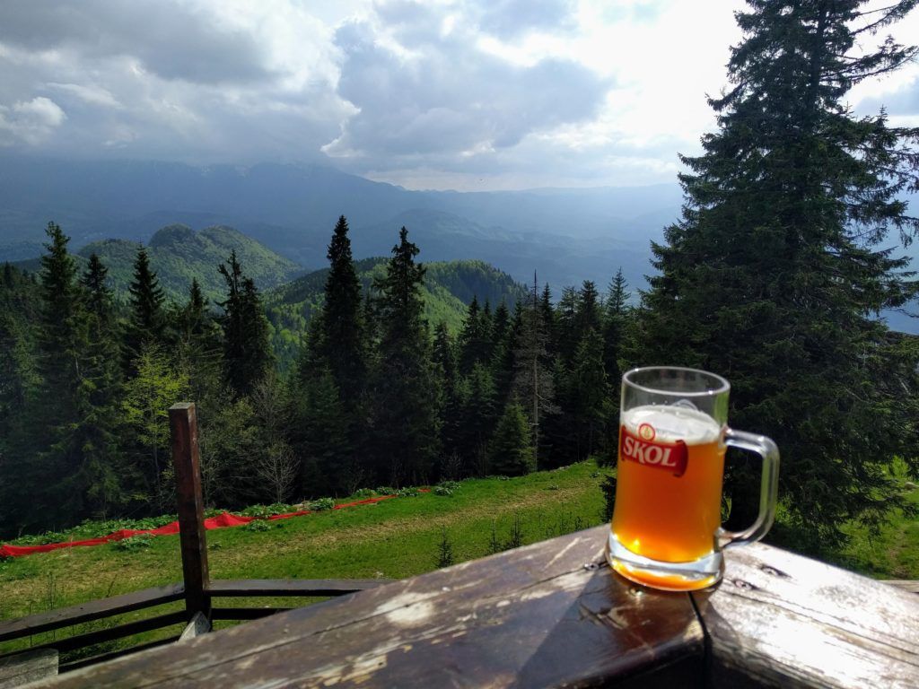
Cabana Postăvarul is a nice german style chalet with a restaurant and terrace.
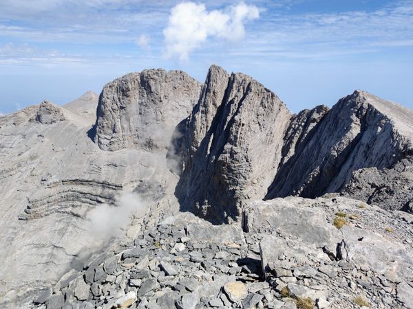
Postavaru Peak (1799 m)
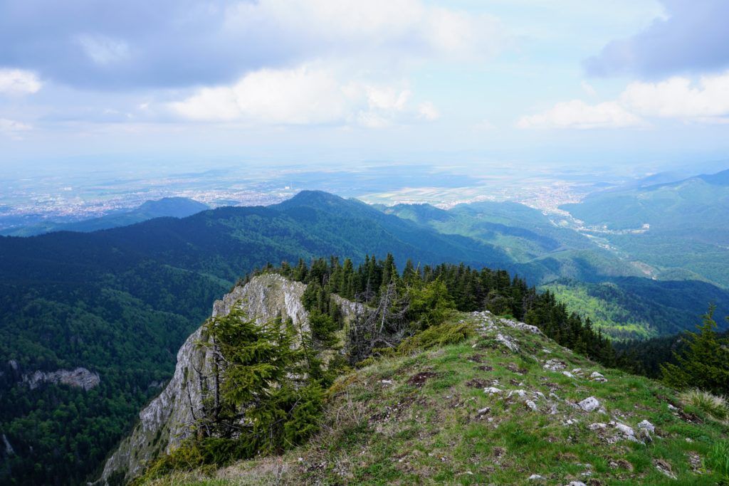
From Cabana Postăvaru you can reach the top, Vârful Postăvaru, by following the blue stripe markings for about 30 minutes.
The path becomes a bit steeper, but it’s not difficult. There are some slippery rocks just before reaching the summit so watch your step and hold on to the iron railings.
The view from the top is panoramic, you can see the Bucegi, Piatra Mare Mountains and Piatra Craiului mountains.
Descending from Postăvarul Peak to Brașov
From Postăvarul Peak we descended to the cable car station and from there directly towards the lake in Poiana Ruia by following a steep, unmarked path that intersected the blue stripe trail near the lake. This path is actually a ski slope in the winter, called Sulinar.
We continued on the blue stripe markings (the same path we came) until we reached the intersection with a trail marked with yellow stripe with a signpost pointing towards Pietrele lui Solomon (Solomon’s stones).
This trail seemed less beaten, it started as a narrow dirt path that soon transformed into a steep, muddy and rocky forest road that continued for 2 km until we reached a wide intersection from where we started a nice and slow descend on a pebble road.
Note: Watch the markings (yellow stripe). At some point you will have to leave the pebble road as the trail continues to the left through the forest towards Pietrele lui Solomon.
Pietrele lui Solomon
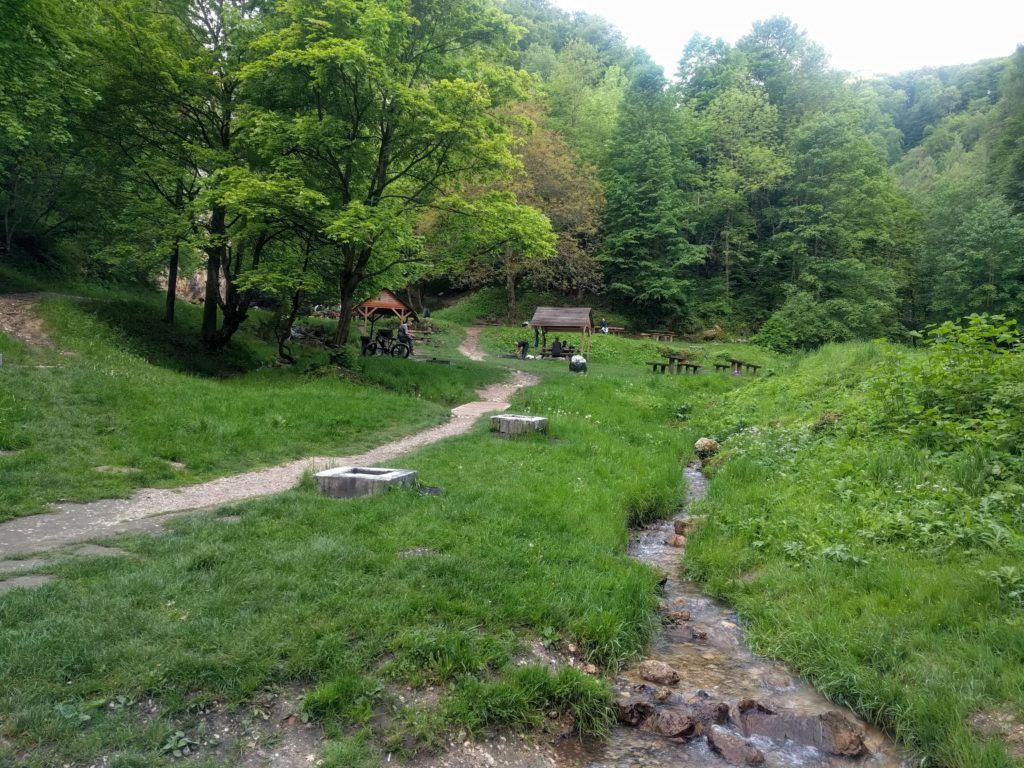
At Pietrele lui Solomon there is a picnic area with many places for making barbecue.
Schei neighborhood
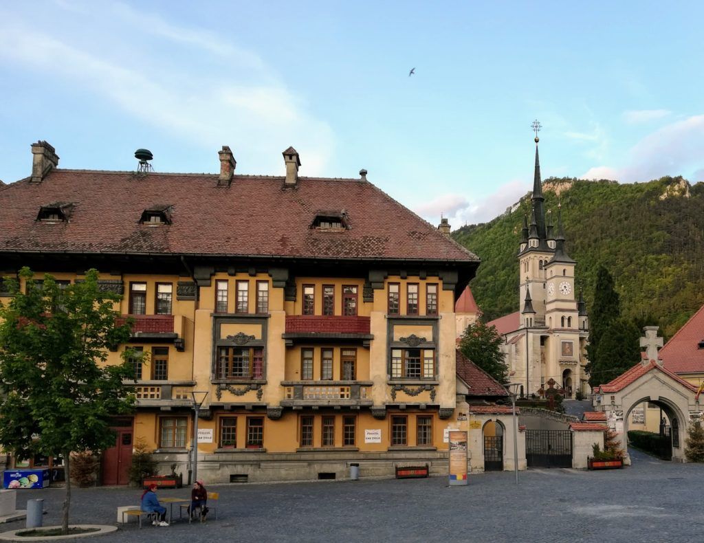
The trail ends once you reach the asphalt road, 3 km away from the center of Brasov. There is a bus station at the end of the trail, but we decided to walk towards the center of Brasov through the nice Schei neighborhood.