Retezat Mountains, Romania – glacial lakes, moraines and high peaks

Many consider Retezat to be the most beautiful mountains in Romania. We wanted to see for ourselves so we left Bucharest for a 3 day trip in Retezat mountains.
It was the beginning of November, which is off season for Retezat. Even if the days are shorter, the weather is more stable in autumn and it’s a great time to visit Retezat while avoiding the crowds.
Getting at the foot of Retezat Mountains, near the village of Cârnic, is a rather long drive from Bucharest. We knew we would spend most of the first and the third days of our trip on the road, allowing just one full day of hiking.
We wanted to make the most of our time so we asked the locals about the most beautiful one day trek in Retezat National Park and it was completely worth it.
The plan was to stay at Cabana Gentiana hut for 2 nights and hike from there for one full day.
From Cabana Gentiana we would embark on a 12 hour, ~20 km loop hike that would pass by Pietrele and Bucura glacial lakes, climb Peleaga and Păpusa peaks, descend via The Closed Gates ridge (Portile Inchise) to Galesul Lake and get back to Cabana Gentiana hut after making a quick detour to The Tarn Between The Trees (Taul Dintre Brazi).
Retezat Mountains
Retezat Mountains are located in the western part of Romania. They are part of the Southern Romanian Carpathians and are relatively high mountains, with 7 peaks over 2400 m.
The highest peak is Peleaga (2509 m), followed by Păpusa (2508 m) and Retezat (2463 m).
Retezat mountains are well known for the high number of glacial lakes. More than 50 permanent glacial lakes – a third of the glacial lakes in Romania – are located here, either grouped in clusters or isolated.
Here you will find the largest glacial lake in Romania, Bucura Lake, with an area of over 10 hectares and the deepest glacial lake in Romania, Zanaoga, with a depth of 29 meters.
Hiking in Retezat – trail profile
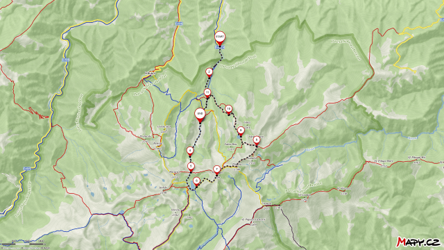
Hiking in Retezat – Trail summary
Blue stripe, then blue triangle: Carnic – Cabana Gentiana hut: 3 h
Blue stripe: Cabana Gentiana hut – Lacul Pietrele glacial lake: 1.5 h
Blue stripe: Lacul Pietrele glacial lake – Curmatura Bucurei saddle – Lacul Bucura glacial lake – Salvamont Bucura Refuge: 1 h
Yellow cross: Salvamont Bucura Refuge – Varful Peleaga peak: 2 h
Yellow cross: Varful Peleaga peak – Saua Pelegii saddle – Varful Papusa peak: 1.5 h
Red stripe: Varful Papusa peak – Portile Inchise ridge – Saua Varful Mare saddle: 1 h
Red triangle: Saua Varful Mare saddle – Lacul Galesul glacial lake: 0.5 h
Red triangle, then red dot: Lacul Galesul glacial lake – Taul Dintre Brazi lake: 1h
Red dot, then red triangle, then blue triangle: Taul Dintre Brazi lake – Cabana Gentiana hut: 2h
Start of the trail – Cârnic (1000 m)

The trail towards Cabana Gentiana hut starts near the village of Cârnic. Coming from Hateg on E79, turn right towards Salasu de Jos and continue on DJ667A towards Cârnic. The last 6 km consist of a gravel road which at the time we visited was in good condition.
After passing the last chalets in Cârnic, you will soon get to a parking lot where you can park your car for free.
From Cârnic to Cabana Gentiana (1670 m)
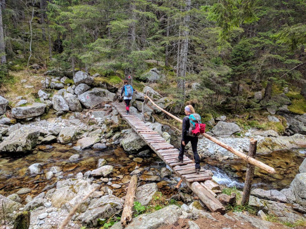
In order to get from Cârnic to Cabana Gentiana you have to hike for about 8 km (3 hours) through the forest.
From the parking lot in Cârnic, follow the blue stripe markings for about 1 hour until you intersect with the blue triangle markings and from there start following the blue triangle along Valea Pietrele river.
At first the path is narrow and at some points slippery, but soon it will turn to the right and enter the forest. From there on it will be an easy 2 hour hike towards Cabana Gentiana hut.
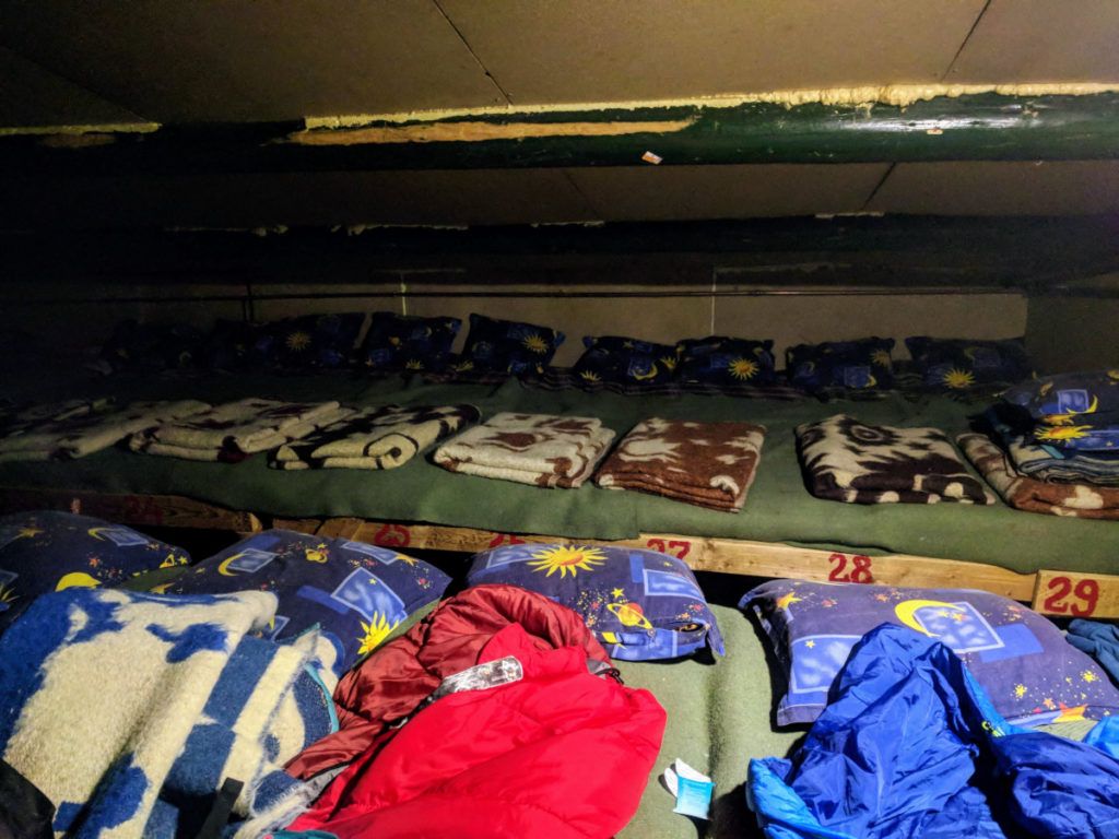
Cabana Gentiana hut (1670 m)
Cabana Gentiana phone number: +40733963292
Cabana Gentiana is an isolated mountain hut and provides only basic facilities, but it should be more than enough for spending a night or two in the nature.
It is open 24h, all year round. It is recommended to book in advance.
It offers accommodation for around 40 people in the bunk beds located at ground floor in the room next to the dining area, and in the attic. They offer wool blankets, but it’s recommended to bring your sleeping bag during winter.
They don’t serve food, but you can purchase tea, coffee and beer. There is a spring with drinkable water near the chalet.
The toilet is located outside. It is a pit latrine, a few meters away from the chalet.
Starting our trek
We woke up at 5 AM and had some breakfast. The tenant was kind enough to make some tea and coffee for us even if it was so early in the morning.
We packed light, carried around 3 liters of water per person and 3 layers of clothes.
We started the hike at 6 AM, while it was still dark. Two of the three dogs at the chalet decided to accompany us on our trip, hoping for some treats, unaware of the intensity of the hike.
Pietrele glacial lake (1990 m)
From Cabana Gentiana (1670 m) we started hiking up, following the blue stripe markings and soon we exited the forest and entered the dwarf pine area.
We got to Pietrele glaical lake (1990 m) in about 1h30m. It was an easy hike, the path was not steep and the views were great.
This segment of the trail is suitable for anyone, even for kids.
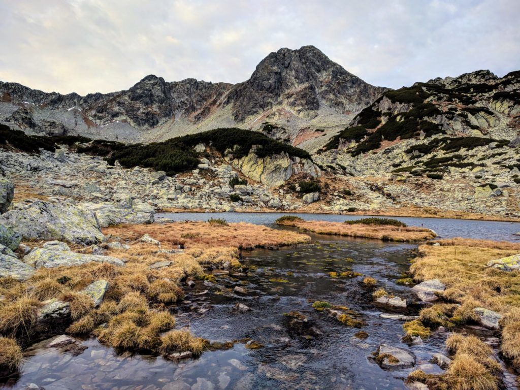
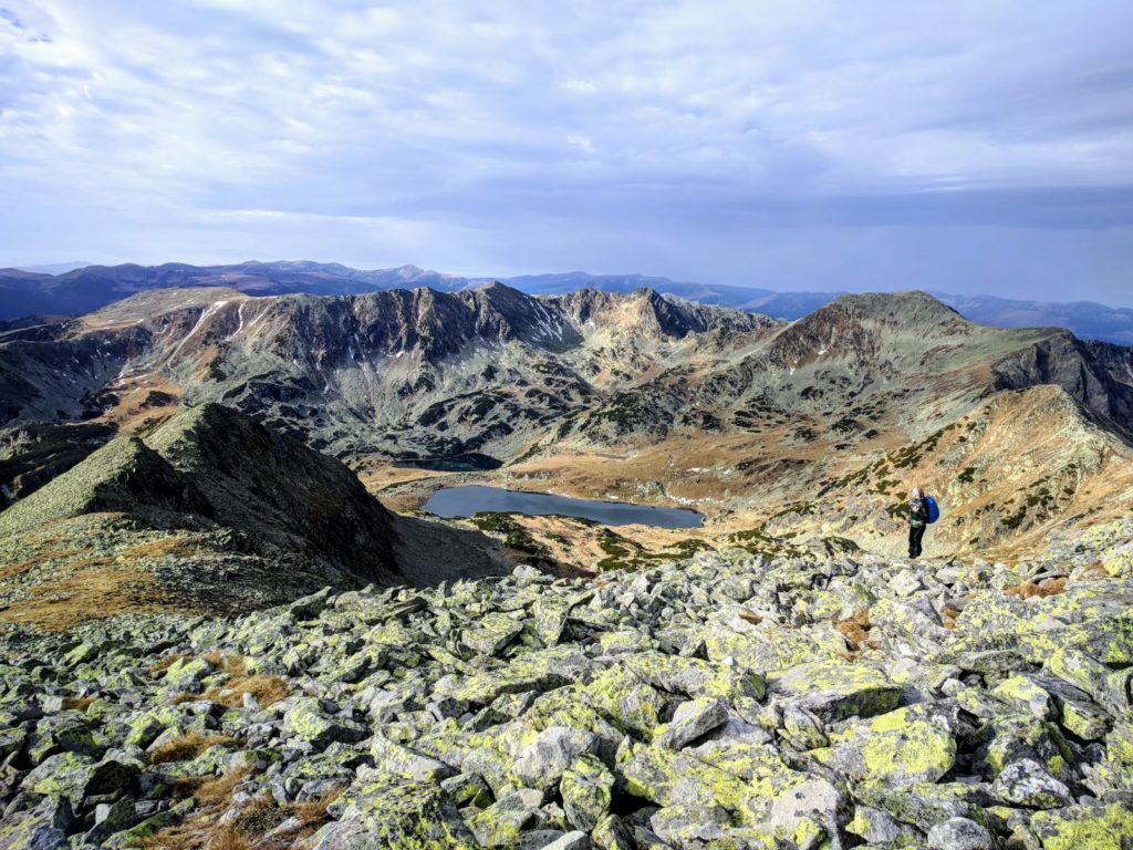
Bucura glacial lake (2040 m)
In order to get from Pietrele Lake (1990 m) to Bucura Lake (2040 m) we first had to climb to Curmătura Bucurei saddle (2206 m).
From Pietrele Lake we continued on blue stripe towards Curmătura Bucurei saddle as the ascent was starting to get steeper and the path rockier.
We were very excited about the scenery around us. The rocks of different shapes and sizes are called moraines and are the work of the Quaternary glaciers eroding the mountain.
After 30 minutes we reached Curmatura Bucurei saddle (2206m). From there we descended towards Bucura lake and in 30 minutes we got to Bucura Salvamont Refuge.
Bucura Salvamont Refuge (2050 m)
Bucura Salvamont Refuge is a small hut located near Bucura Lake, 30 minutes away from Curmatura Bucurei saddle. It is a bivouac refuge and it can accommodate 10 people. You are only allowed to use it as a shelter in case of bad weather or other emergencies.
Between June 15th – September 15th the refuge is used by the Salvamont team – the Romanian mountain rescue service.
If you decide to spend the night there, please keep it clean and remember to close the door when you leave.
At the left of the refuge there is a spring with drinkable water.
Camping is allowed near Bucura lake. During summer it gets very crowded but in November the place was deserted.
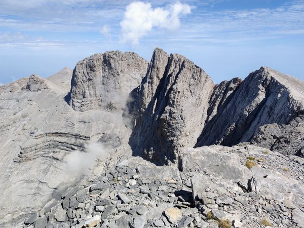
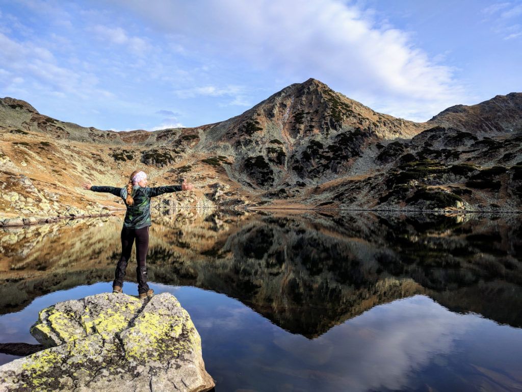
Peleaga Peak (2509 m)
From Bucura refuge we headed up towards Peleaga Peak following the yellow cross markings. We reached the top in about 2 hours.
The view from the top is amazing. From Peleaga Peak you have a nice view over Bucura and Ana lakes at SW, Retezat Peak at NW, the tarns (small lakes) from Valea Rea valley at NE, Peleaga (Ghimpele) glacial lake and Păpusa Peak at East.
Hiking from Bucura Lake to Peleaga Peak is forbidden during winter due to high risk of avalanches.
Păpusa Peak (2508 m)
Peleaga (2509 m) and Păpusa (2508 m) are almost the same height, but are separated by Saua Pelegii saddle.
From Peleaga Peak we started to descent on yellow cross towards Saua Pelegii saddle (2285 m).
While descending, at the left we could admire Coltii Pelegii (The fangs of Peleaga) and below, at the right, The Peleaga Tarn.
From Saua Pelegii saddle we continued hiking up on yellow cross towards Păpusa Peak (2508 m).
We reached Păpusa Peak in 1h15m after leaving Peleaga Peak.
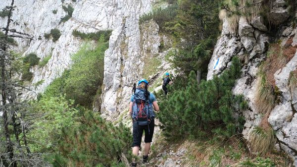
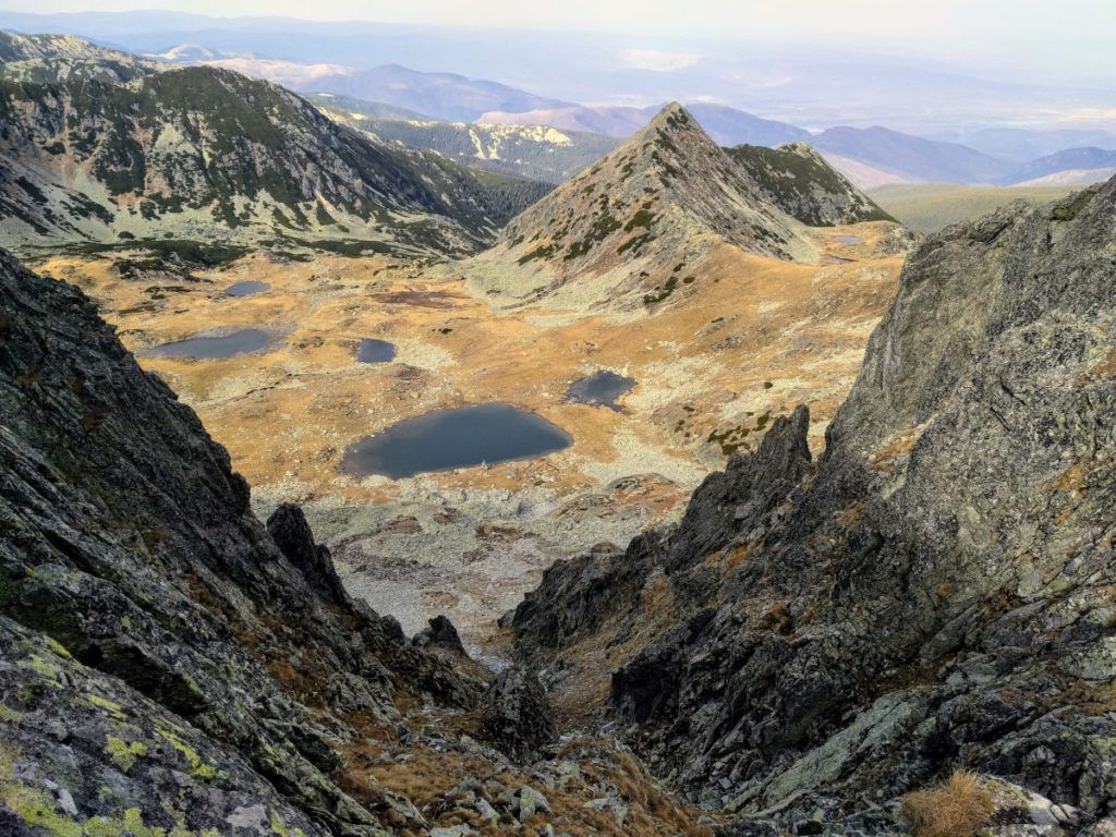
Portile Inchise (The Closed Gates Ridge)
From Păpusa Peak we headed on red stripe towards Portile Inchise ridge (The Closed Gates).
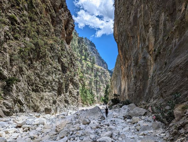
Portile Inchise is a narrow, rocky ridge where you will need to climb using your hands. It is not suitable for beginner hikers or for those afraid of heights. The path is exposed and not very well maintained.
Despite the fact that the path requires increased attention, the view from the ridge is truly amazing.
At the left we could admire Galesul Lake. At the right, down in the glacier caldera lays Taul Tapului glacial lake (2130 m), one of the most beautiful lakes in Retezat Mountains. It is easy to recognize it – it’s the one with a small island on it.
There was one portion where we had to hold on to a rusted cable in order to descend. The two dogs that where accompanying us had a lot of trouble crossing this part of the trail as we were unable to help them. They managed to find a way around it as we cheered for them.
It took us about one hour to reach in Saua Varful Mare saddle (2370 m) from Păpușa Peak.
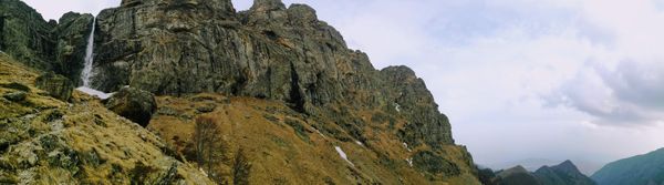
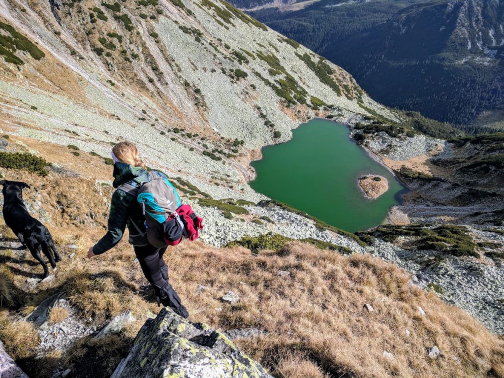
Galesul glacial lake (1990 m)
From Saua Varful Mare saddle (2370 m) we started the descend towards Galesul Lake on the red triangle markings.
The path was rather steep and it was covered by scree but the view over the moraines and the lake below was amazing.
Before reaching the lake we had to walk through a huge maze of dwarf pines and huge moraines. We lost the markings at some point, but the direction was clear since we could see the lake.
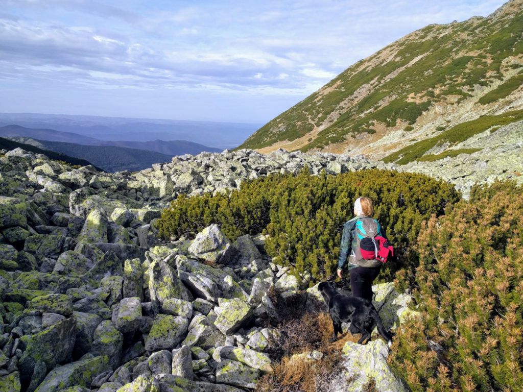
Taul Dintre Brazi (1710 m)
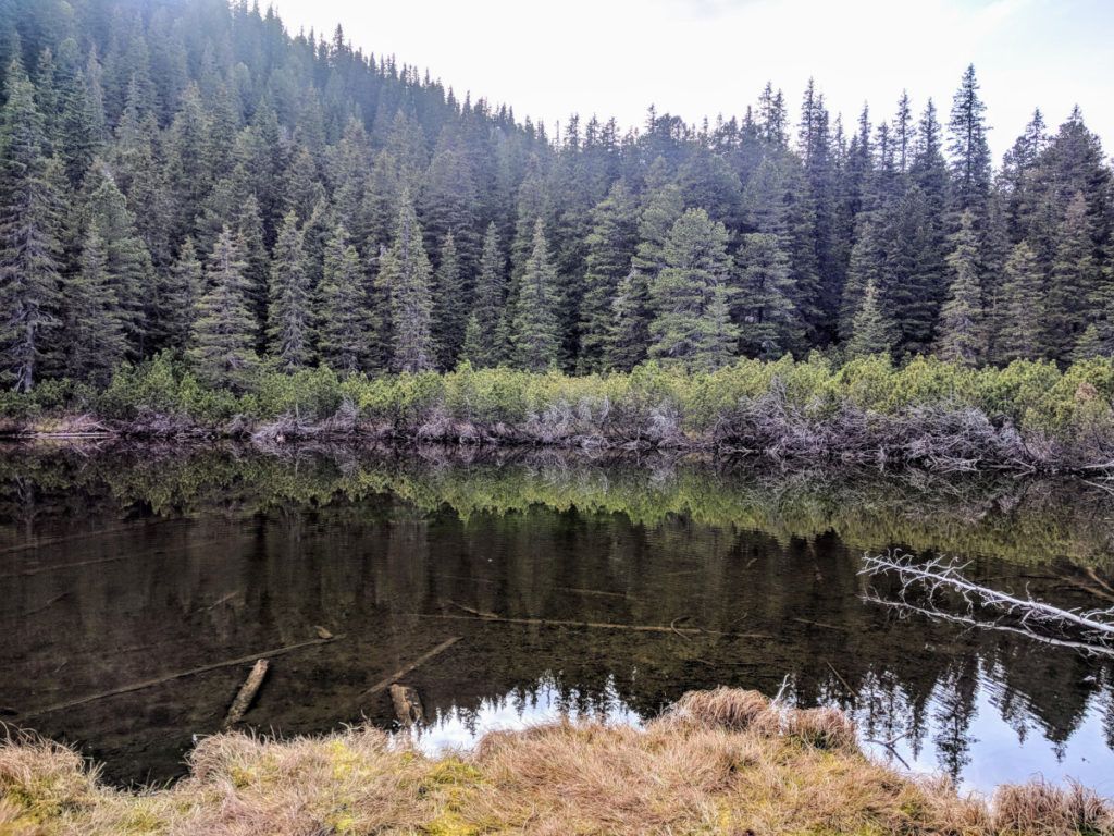
From Galesul Lake we slowly descended for a while on red triangle, on a path between the dwarf pines until we intersected with the red dot markings in the forest.
We followed the red dot markings in order to get to Taul Dintre Brazi (The Tarn Between the Pine Trees), a picturesque, non glacial lake surrounded by pine trees, as the name suggests, and luxurious vegetation during summer.
Back to Cabana Gentiana Hut
From Taul Dintre Brazi we continued on red dot until we reached again the red triangle. We started following the red triangle until we intersected with the blue triangle trail that leads to Cabana Gentiana hut (the same trail we took the night before).
We managed to reach the chalet before it got dark, after a 12h vigorous hike that left us completely amazed of how beautiful Retezat Mountains are.