Bran Castle and Beyond: A Hiker's Journey in Moieciu de Sus
Explore the scenic trails around Moieciu de Sus near Bran Castle. A moderate hike that offers panoramic views over Piatra Craiului Mountains and the serene beauty of the Bucegi Mountains.
Looking for a moderate day-hike close to Bran Castle? We suggest this lovely trail around the village of Moieciu de Sus.
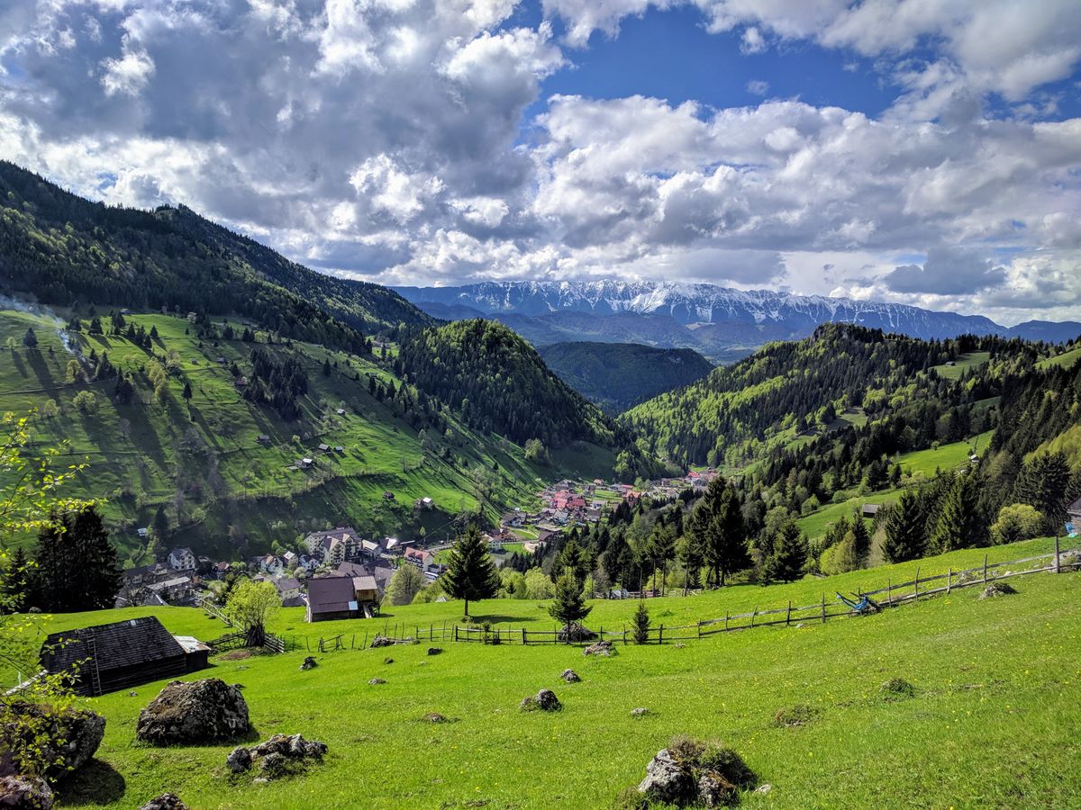
Moieciu de Sus is a beautiful village in the Rucar-Bran Pass, right at the base of the Bucegi Mountains. It's surrounded by stunning hills and mountains and is only 10 km from Bran Castle and 40 km from the city of Brasov.
As you follow the trail, it takes you up to a height of 1909 meters, to Refugiul Saua Strunga. Along the way, you'll be treated to amazing views over the Piatra Craiului Mountains in the distance and the west side of the Bucegi Mountains. It's truly a sight to see and a great way to spend a day!
Trail Quick Info
- Trail Head: Moieciu de Sus, Brasov County, Romania
- Length: 21 km
- Duration: 6-8 hours
- Difficulty: Easy to moderate
- Trail Markings: Red hiker on white background, red stripe, red cross
- Distance from Bucharest: 200 km (Approx. 3 hours by car)
- Parking: Free parking available on the side of the road
- Closest Accommodation: Guest houses in Moieciu de Sus.
Difficulty
The hike offers a blend of easy to moderate challenges, spanning 21 km in length. Expect to spend around 6-8 hours to finish the trail.
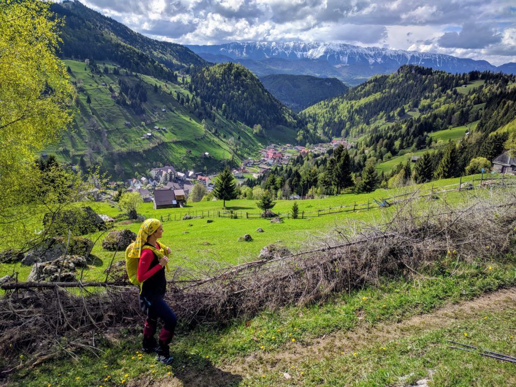
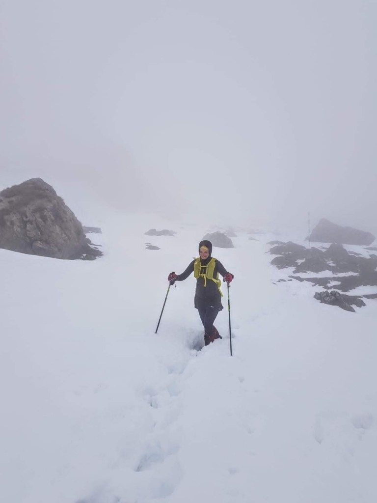
For a visual perspective, all the images showcased in the article were captured on May 11th, 2019. Interestingly, while Moieciu de Sus enjoyed a warm ambiance, areas above 1800 meters still had a generous blanket of snow on the trail.
Map
You can explore the map on the muntii-nostri.ro website from where you can also purchase paper maps in both Romanian and English.
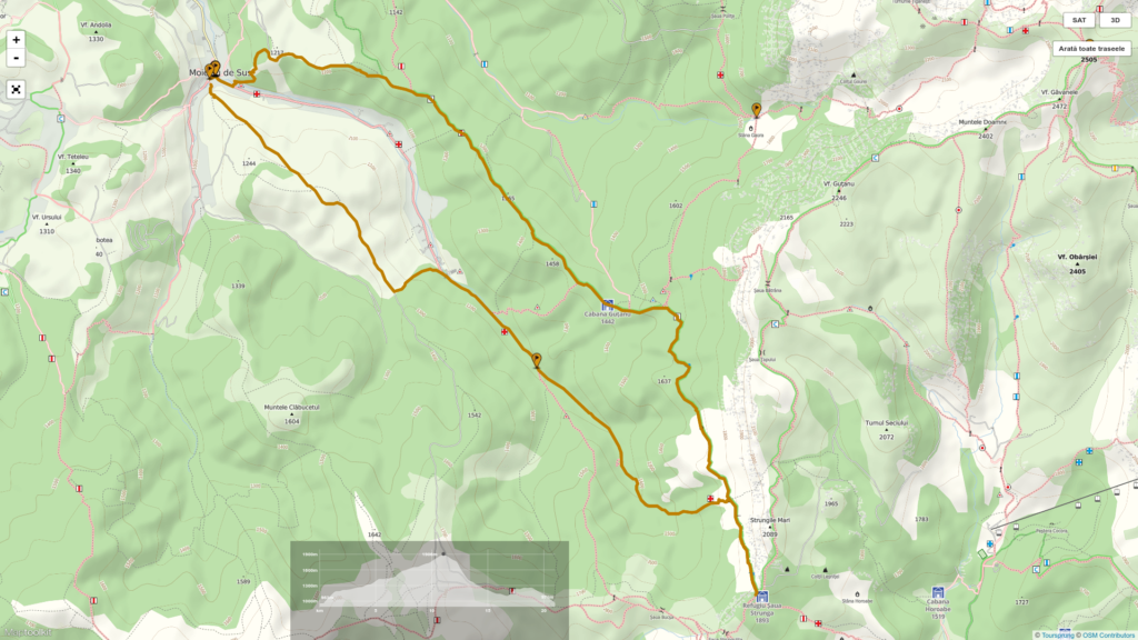
Trail profile and GPS track
You can download the GPS track from the wikiloc.com website. Wikiloc is a nice app you can use for navigation.
Equipment Checklist:
- Hiking Shoes: Ensure they're comfortable for the journey.
- Clothing: Prepare with 3 layers, as temperatures can drop significantly at 1900 meters.
- Water: Carry a minimum of 1.5 liters to stay hydrated.
- Food: Pack enough sustenance for the day.
- Sunscreen: Protect your skin from the sun's rays, especially at higher altitudes.
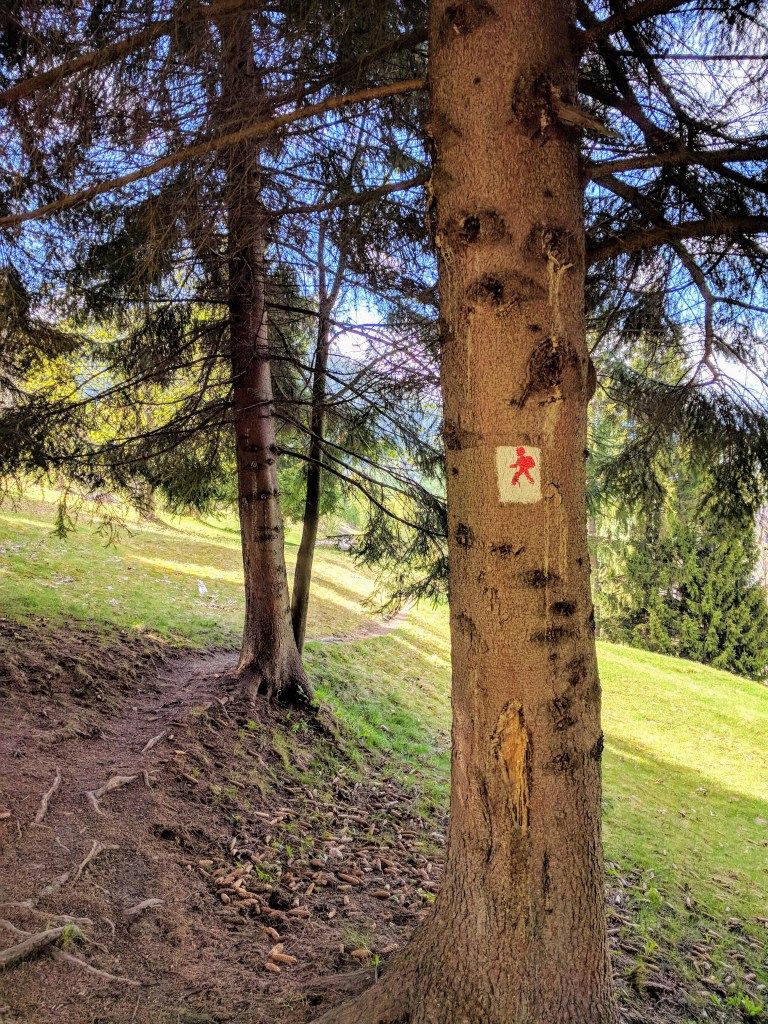
Trail Markings Guide
Trail Markings Breakdown:
- First 3 km: Marked with a red hiker figure on a white background.
- Up to Refugiul Saua Strunga: Follow the red stripe markings.
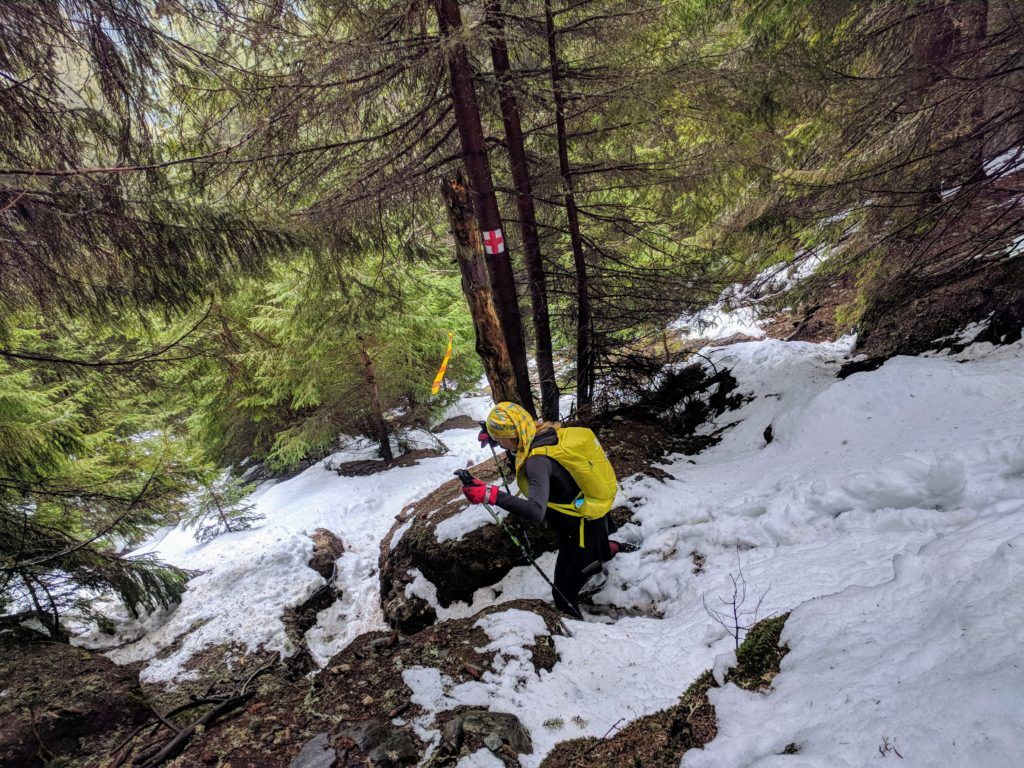
- From Refugiul Saua Strunga: Look for the red cross markings.
- Last 4 km: Again, marked with a red hiker figure on a white background.
Stay attentive to these markers to ensure you're on the right path throughout your hike.
First 3 km & Last 4 km: The trail is subtly marked with a red hiker figure on a white background. It's advisable to consult the map and use a GPS track if necessary for guidance.
Remaining Distance: The rest of the trail is clearly marked, initially with red stripe markings, followed by red cross markings. Ensure you keep an eye out for these as you progress.
Trail Description
Trailhead
The trail starts and ends in Moieciu de Sus, at the intersection of Valea Bangaleasa and Valea Popii streets.
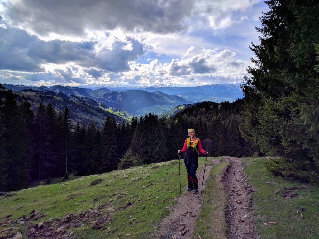
The first 3 kilometers
Start your hike on Valea Bangaleasa street in Moieciu de Sus.
After walking for about 200 meters, keep an eye out for a small wooden bridge on your left. Once you spot it, cross the Turcu river using this bridge.
After crossing, take the dirt path that leads upwards. Although the path isn't marked very well, it should be easy to spot. The beginning of the path is quite steep, but as you continue, it will follow the natural contour lines of the landscape.
Red stripe markings
Approximately 30 minutes into your hike, you'll intersect with a trail that's marked with a red stripe, originating from the village of Simon. From that point onward, stick to the red stripe markings, and they will lead you directly to Refugiul Saua Strunga.
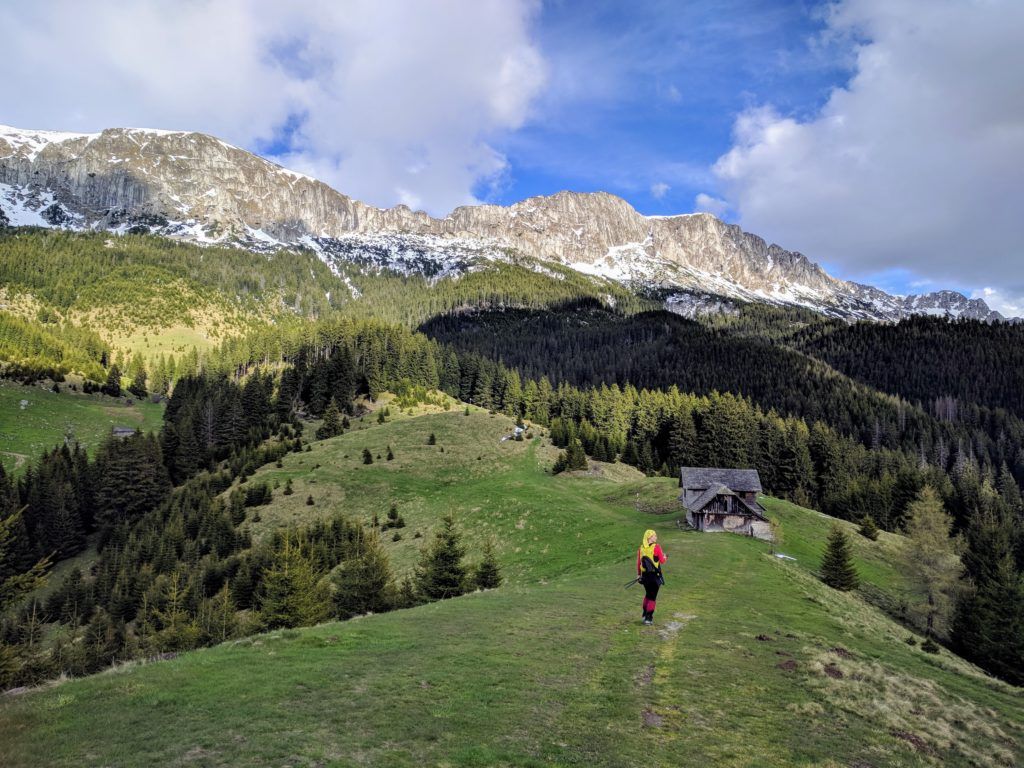
The ruins of Cabana Gutanu hut
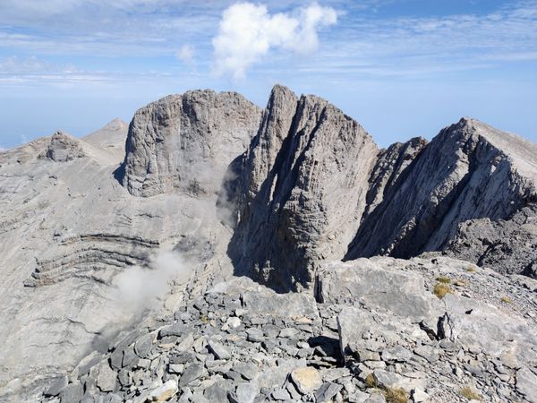
You'll pass the ruins of Cabana Gutanu hut. Ahead, you'll see the striking walls of Strungile Mari.
Sheepfolds
As you head towards Refugiul Saua Strunga, you'll come across several sheepfolds.
A word of caution: the dogs guarding these sheepfolds might bark at you. If they do, remain calm. They typically don't bite unless provoked. Avoid running; instead, stand still or walk slowly and call out for the shepherd.
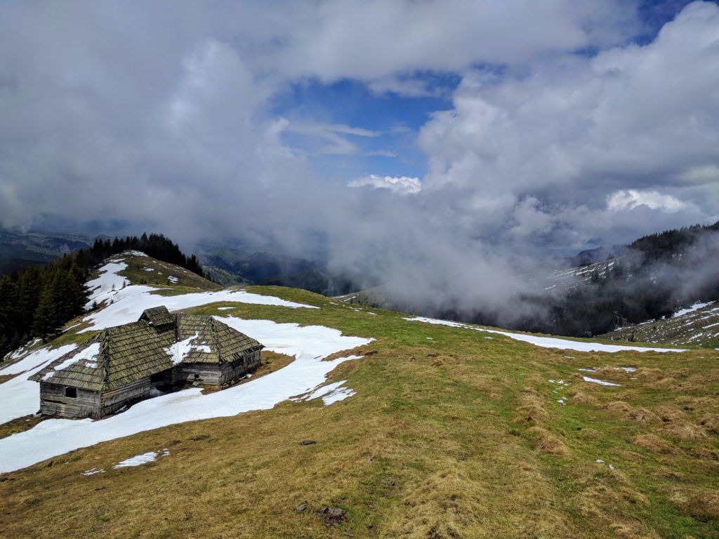
Refugiul Saua Strunga
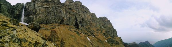
Refugiul Saua Strunga is a mountain refuge perched at an altitude of 1909 m. Having undergone recent renovations, it offers shelter from unpredictable mountain weather or a place to rest for the night, provided you have warm sleeping bags due to the cold temperatures at this height.
It's worth noting that in the first half of May, areas above 1800 meters remained snow-covered. The photo showcased, like all others in this article, was taken on that same day.
Descend back to Moieciu de Sus
From Refugiul Saua Strunga, head back on the same path for about 20 minutes until you see the red stripe and red cross markings split. Follow the red cross markings. This will take you down through the forest, across some streams, and onto a wider forest road. Continue on this road until you reach the barrier at the asphalt road in Moieciu de Sus.
The last 4 kilometers
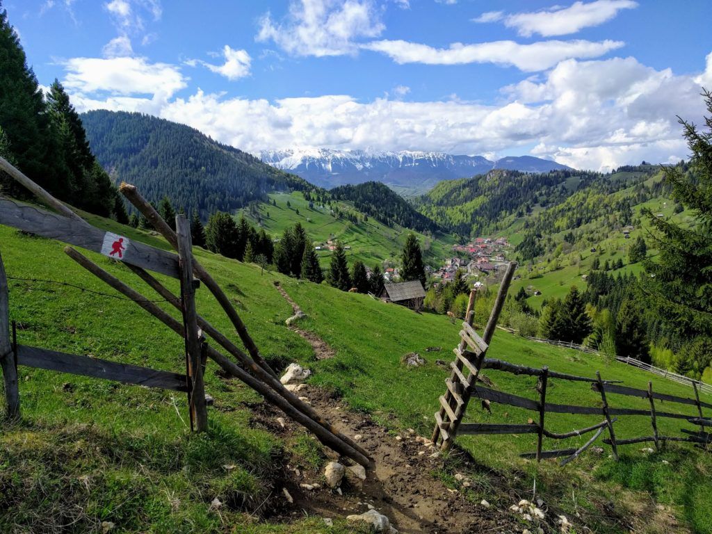
After passing the parking area by the barrier, turn left and take the path that ascends and then veers right.
This path runs somewhat parallel to the asphalt road but is elevated, offering great views. Initially, it's quite wide but narrows as it winds through local residents' yards. You'll encounter small wooden gates along the way. Go through these gates and ensure they're left in their original state, whether open or closed. Avoid climbing over fences to prevent damage and to maintain good relations with the locals. Always search for the proper gate entrance.
Follow the red hiker figure markings. They will guide you back to the starting point of your journey. Safe travels!