Morarului Valley – a spectacular and wild trail towards the summit of Bucegi
The trail through Morarului Valley is an unmarked, spectacular and wild path towards Omu Peak (Varful Omu – 2507m) – the highest peak in Bucegi Mountains, Romania
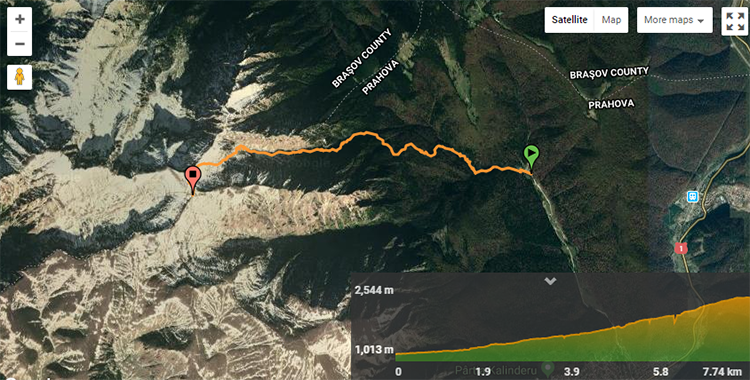
The hike starts at Gura Diham (987 m) and takes about 4.5 hours to reach Omu Peak.
This unmarked trail ascends a steep alpine valley and can be dangerous in certain conditions. Only go if you are an experienced hiker who enjoys scrambling and there is no threat of heavy rain, fog, or snow.
Avalanches can occur in the winter, and flash floods can occur in the summer. This trail is best hiked in the autumn season (late August to late October) because the weather is more stable and the path is not covered in snow.
You must be in good physical condition to hike this trail. Keep an eye out for the path, which may become less visible in some areas of the trail. To prepare, review the map and the images below and follow the GPS track.
Wild animals
To avoid any unpleasant encounters, simply speak loudly enough for wild animals, such as bears, to hear you in time. They, too, do not want to meet humans; if they hear you, they will retreat out of the way before you even get a chance to notice them. There is no need to generate noise pollution, like yelling or blowing a whistle.
Equipment needed
- helmet (minor rockfalls can occur)
- hiking boots
The trail becomes more technical near the end and requires some scrambling, but no special climbing equipment is required if there is no snow (usually from August to November).
Make sure you have good hiking boots and plenty of water, as there may be no water sources along the way.
Quick info about Morarului Valley trail
- Starting point: Cabana Gura Diham (982 m)
- Destination: Omu Peak (2507 m)
- Seasonality: only in good weather, avoid during winter
- Duration: 4.5h
- Length: ~7km
- Markings: not marked
- Difficulty: moderate (some scrambling involved)
- Closest accommodation unit to the start of the trail: Cabana Gura Diham (right next to the trail)
- Closest town to the start of the trail: Busteni (5km)
- Distance from Bucharest: 153 km (2-3h) by car, 2h by train to Busteni train station
- Parking: free public parking near Cabana Gura Diham
Morarului Valley trail description
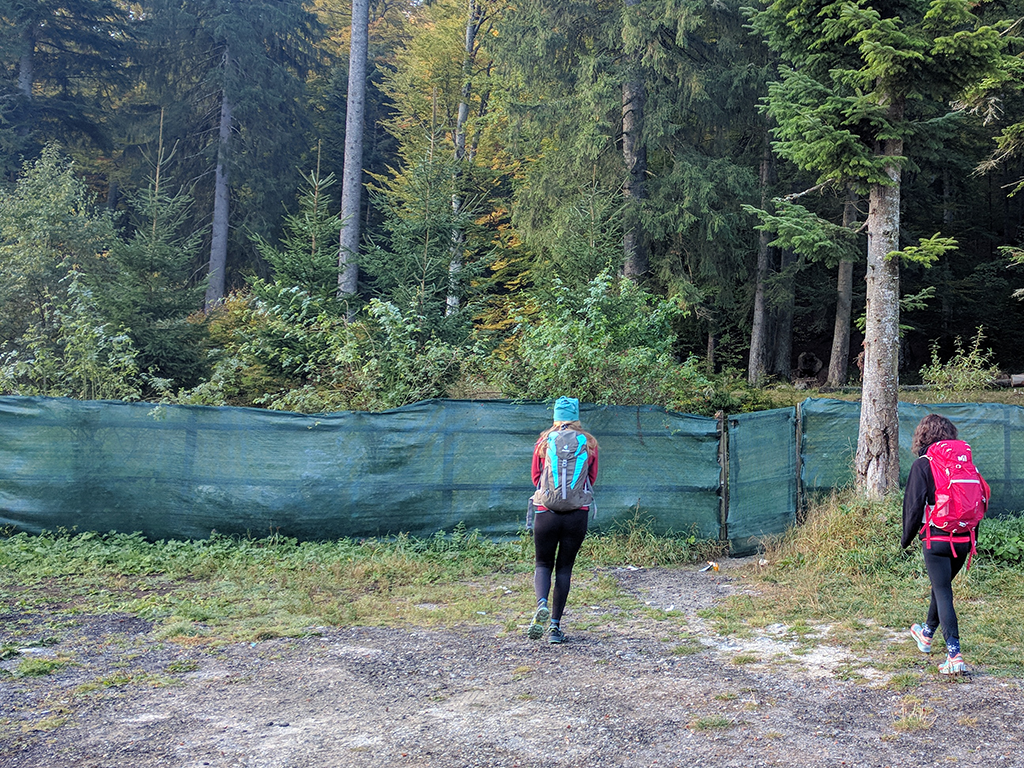
Start of the trail
In order to get at the start of the trail, go through the (not so obvious) gate in the green fence on the left of Gura Diham Chalet. If you can’t find the gate, stop here because this trail is not marked and will put your orientation skills at test. You can take this very well marked trail towards Omu Peak instead.
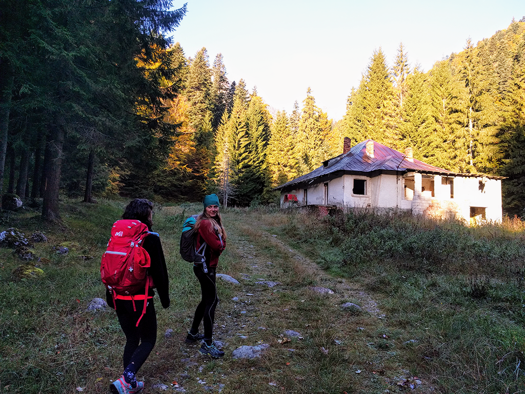
Deserted building and right turn
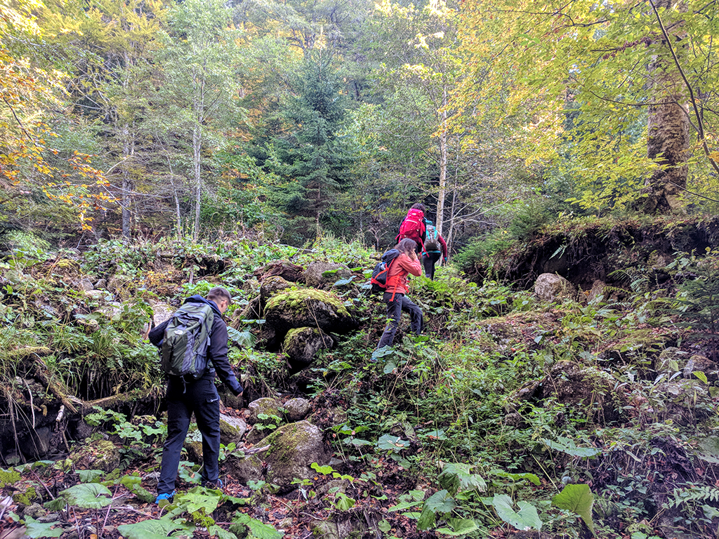
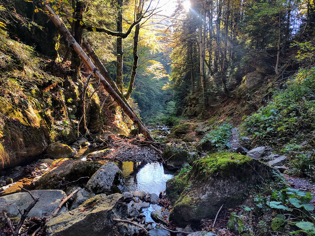
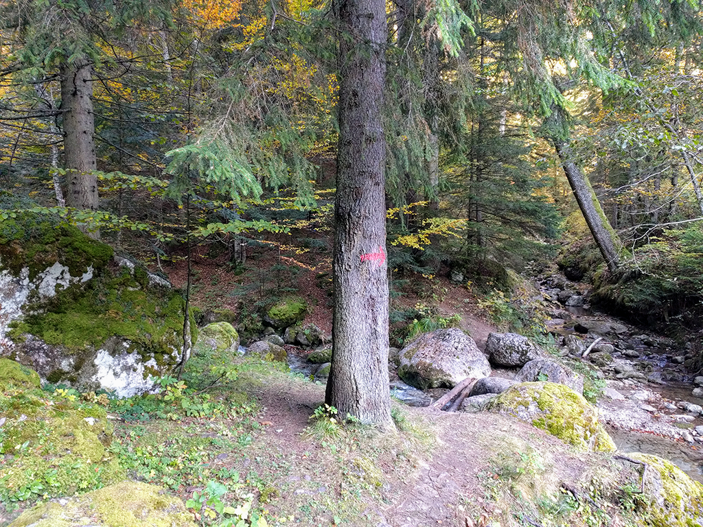
Cross the Valea Cerbului river, then turn right onto the forest road. After passing by a deserted building, look for an arrow pointing right on a tree. Moraru river merges with Valea Cerbului river here. Cross the river again and continue along the Moraru River path.
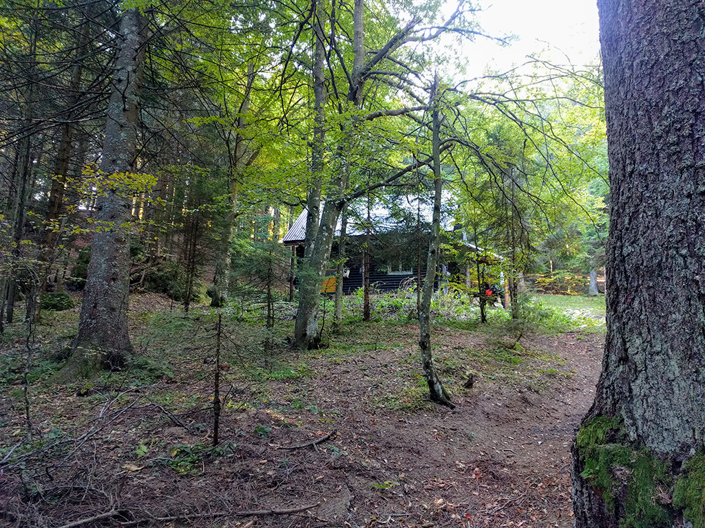
Coltii Morarului hunting lodge and red triangle markings
After a few minutes, the trail bends to the left and begins the steeper climb to the Coltii Morarului hunting lodge. This hut is usually closed.
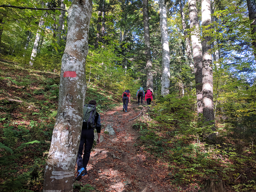
You will join the trail marked with red triangle that comes from Busteni five minutes after passing the hut.
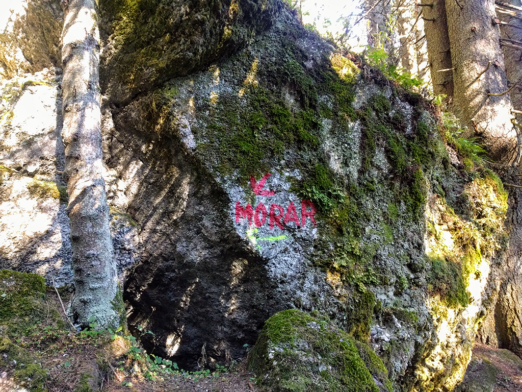
Big rock with arrow and “Morar” painted on it
Follow the red triangle trail until you reach a large rock with the word "Morar" written on it and an arrow pointing left. You should now leave the marked trail and take the path to the left.
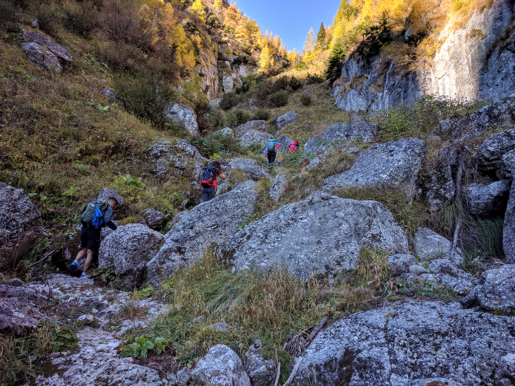
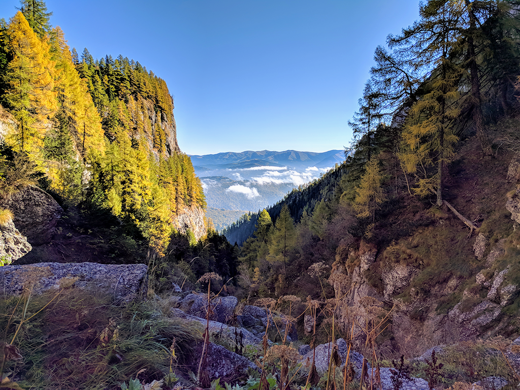
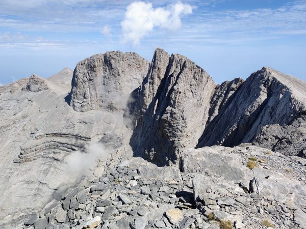
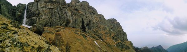
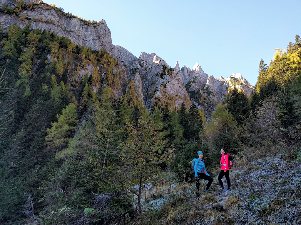
View of Coltii Morarului (Morarului Fangs)
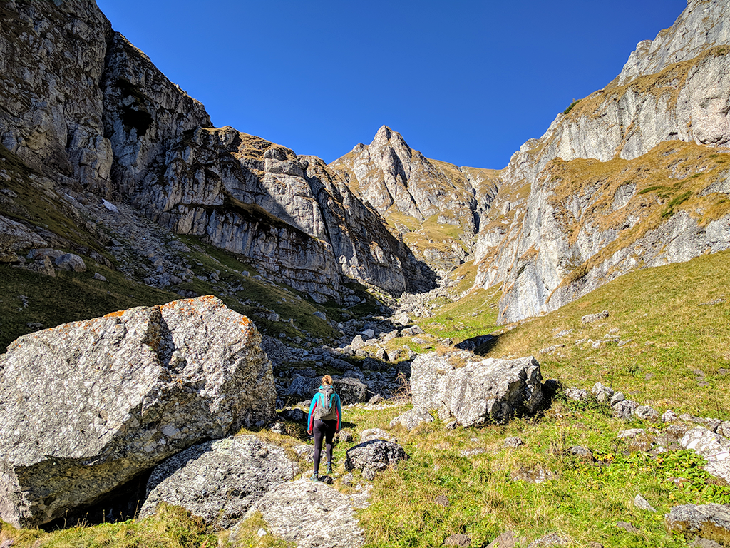
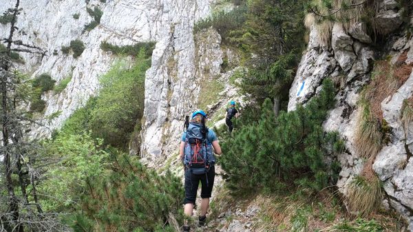
Soon, you'll be rewarded with views of the Coltii Morarului ridge on the left and the Creasta Balaurului (Bucsoiu Mic ridge, also known as The Dragon's Ridge) on the right. The trail becomes more spectacular as it becomes more exposed. It requires some scrambling, but it is not dangerous.
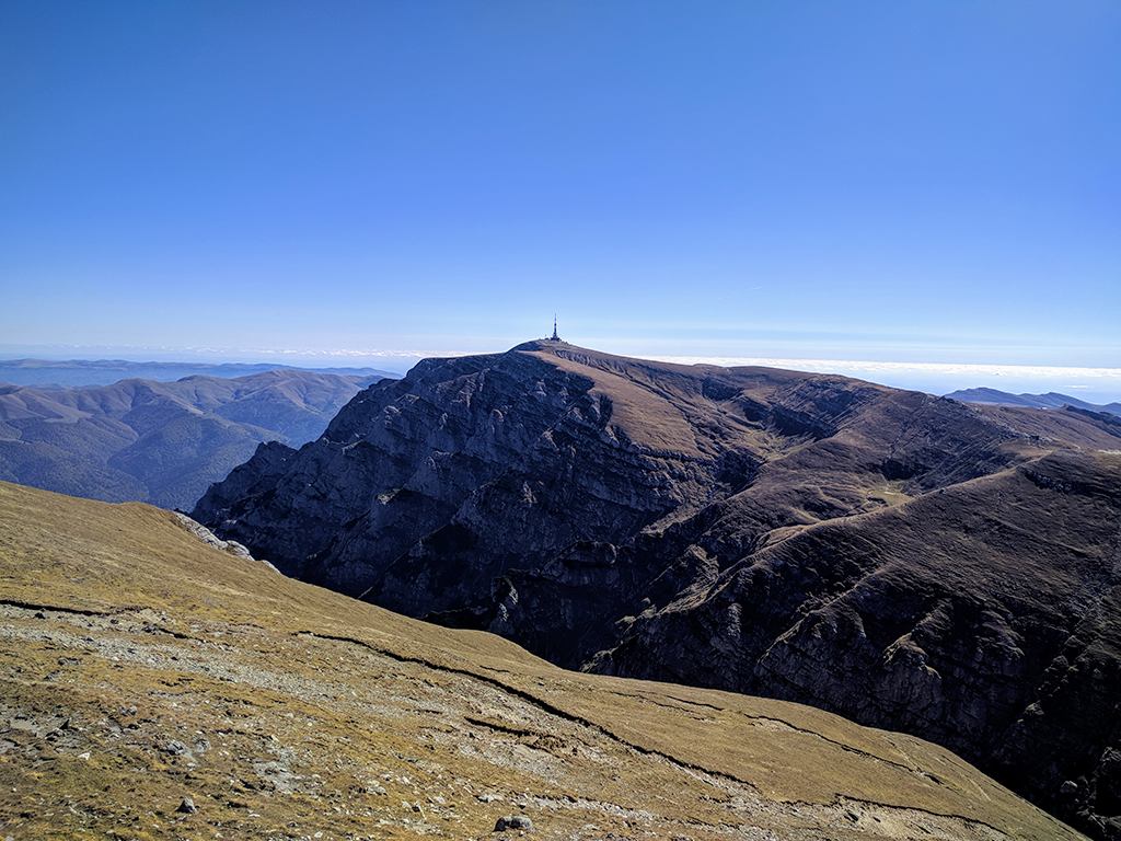
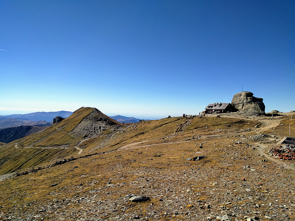
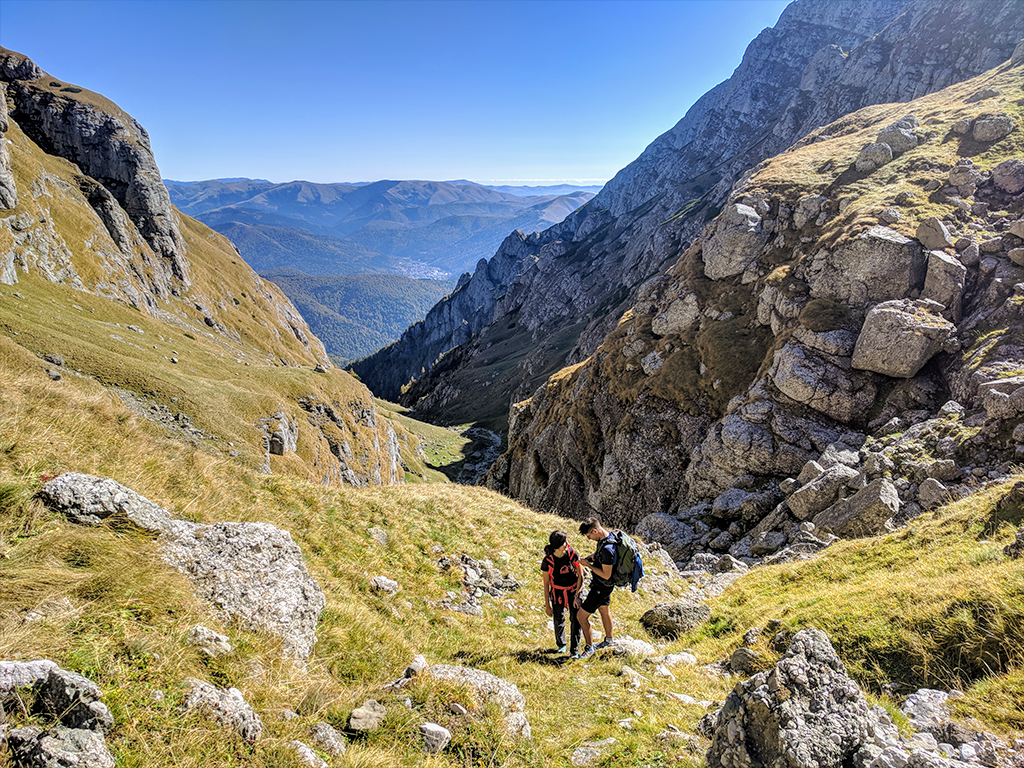
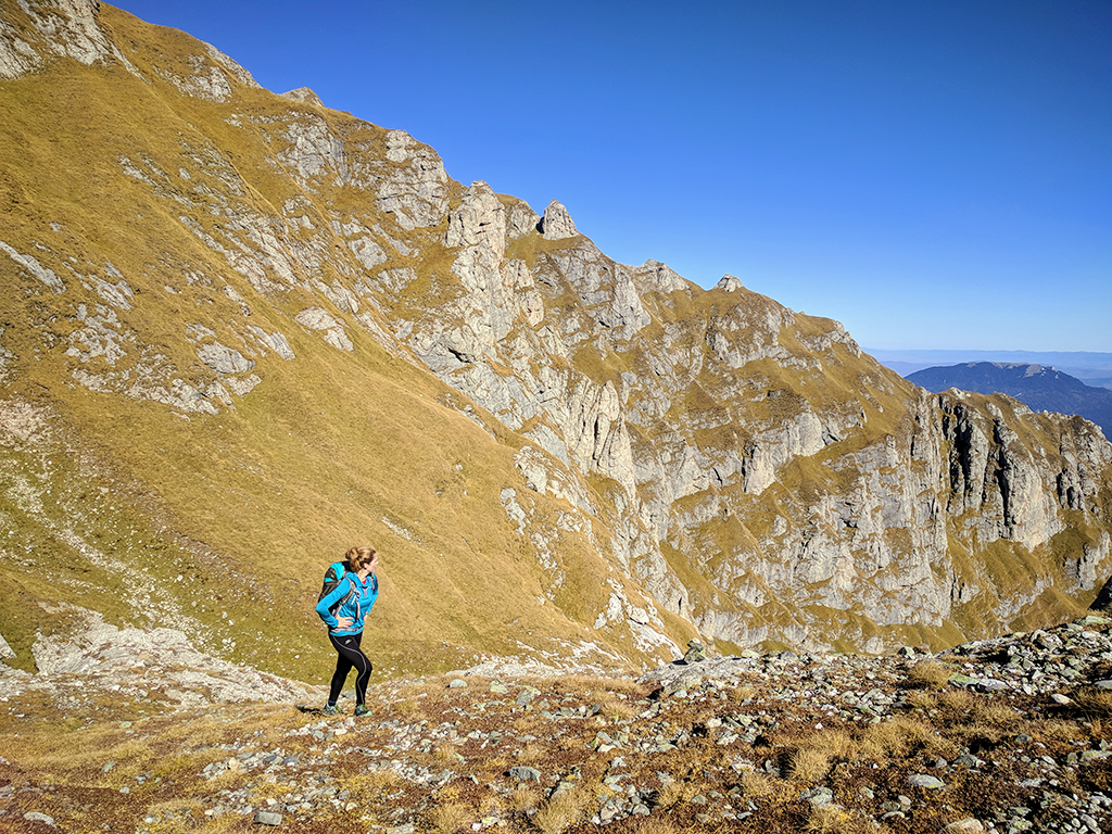
The cirque below Omu Peak
The weather station building at Omu Peak can be seen from here. You can approach it in whatever way you think is best for you. We chose to climb on the left (South) side, towards the Morarului ridge.
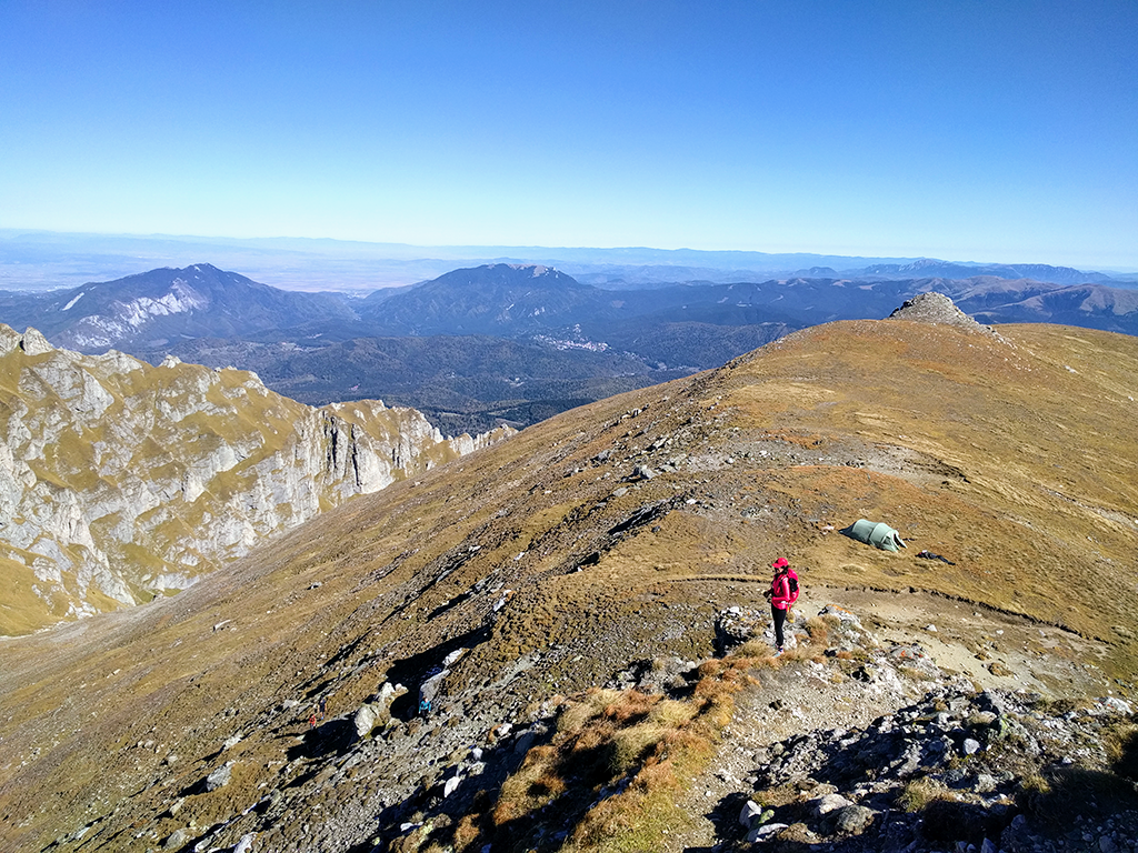
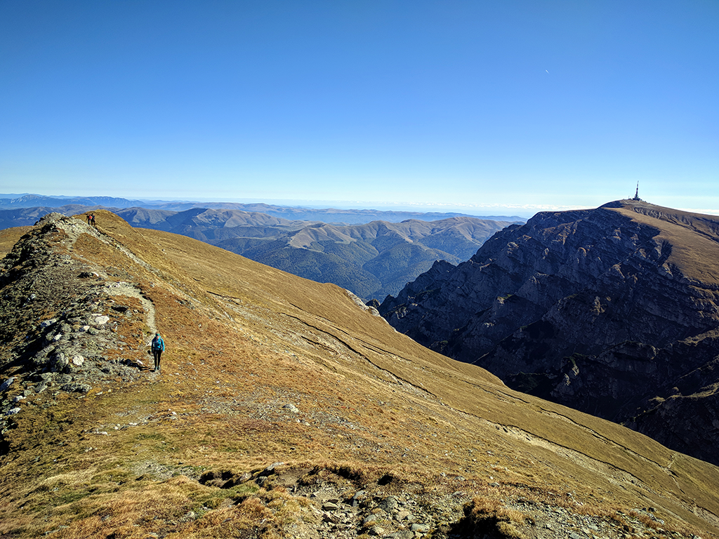
Morarului ridge
From the ridge, you can see Costila Peak (2490 m) to the south, Creasta Balaurului to the north, and the Postavaru and Piatra Mare massifs to the east, followed by the Baiului Mountains and Ciucas Mountains in the distance.
Morarului Valley trail photo gallery