Romania: 3-day hiking trip in Bucegi and Piatra Craiului Mountains

Since so many people have asked us about hiking recommendations in Romania, especially hiking near Bucharest and Brasov, we created this guide in which we describe in detail our favorite treks in the Bucegi and Piatra Craiului mountains.
If you follow this guide you will hike for 3 days on the most spectacular trails in the Bucegi and Piatra Craiului mountains and reach the best viewpoints.
You will reach the highest peak in Bucegi – Varful Omu, the highest peak in Piatra Craiului – Varful La Om (2238 m), and the breathtaking ridges of Bucsoiu, Tiganesti and Piatra Craiului.
In total, you will hike around 60 kilometers with a total elevation gain of 5000 meters.
Quick navigation
- Before you start
- Day 1: Busteni to Omu Peak and Cabana Malaiesti
- Day 2: Cabana Malaiesti to Bran and Magura village
- Day 3: Piatra Craiului ridge and Cabana Curmatura
Before you start
Understand the difficulty of the routes
In order to do the full trip as described in this article, you need to be fit and have enough hiking experience.
You will have to walk on rugged, mountainous terrain for 10-12 hours each day with a lot of elevation gain.
- Day 1: 21 km, 2240 m elevation gain, 1430 m elevation loss
- Day 2: 21 km, 1193 m elevation gain, 1868 m elevation loss
- Day 3: 21 km, 1470 m elevation gain, 1610 m elevation loss
The hike in the Bucegi Mountains is of medium difficulty.
The hike on the Piatra Craiului ridge is difficult. You won’t need any special equipment, but if you are afraid of heights, hiking on the Piatra Craiului ridge may not be for you.
For each day we will soon provide some faster and easier alternatives in case of bad weather or if you think the full hike is too hard for you.
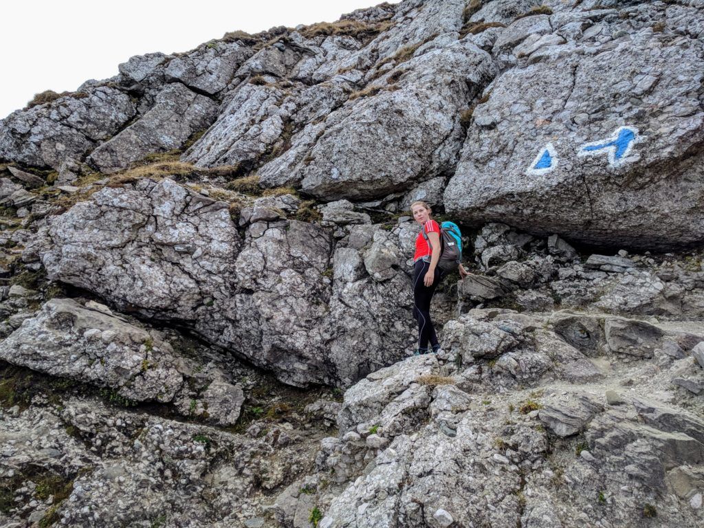
Trail markings
The trails are well marked and in good condition.
Seasonality
These hikes should only be attempted in the summer season (June to October) and on good weather.
Equipment
Since the hikes will be strenuous, it’s recommended to start each hike with at least 3 liters of water in your backpack. Except for this, you will need:
- good hiking shoes
- 3 layers of clothing
- raincoat, sunscreen
- headlamp
- a thin sleeping bag (optional, for sleeping at Cabana Malaiesti).
Accommodation
The plan is to spend the first night at Cabana Malaiesti in the Bucegi Mountains, the second in a guest house in Magura or Pestera villages at the foot of Piatra Craiului Mountains and the third one either at Cabana Curmatura in Piatra Craiului Mountains or at a guest house in the town of Zarnesti.
Transportation
This is not a circuit hike, so it’s better to use public transportation.
Maps
Android app: Zenithmaps
iOS app: Muntii Nostri
Paper and desktop: muntii-nostri.ro
Navigation app: maps.me
Weather
The weather can change very fast in the mountains. During the months of June and July, there are high chances of thunderstorms forming around noon.
Weather forecast for Omu Peak in the Bucegi Mountains: meteoblue.com
Weather forecast for Varful La Om in Piatra Craiului: meteoblue.com
Day 1 – Bucharest to the Bucegi Mountains

ELEVATION PROFILE – DAY 1
- 12 hours of walking, 21 km, 2240 m elevation gain, 1430 m elevation loss
Arrive in Busteni, hike to the Bucegi Plateau, visit Babele, The Sphinx, the Heroes Cross on Caraiman, ascend to Omu Peak and spend to the Malaiesti Chalet.
Arrive in Busteni
The hike starts from the town of Busteni.
The fastest way from Bucharest to Busteni is by train. There are hourly trains that depart from the Gara de Nord train station in Bucharest to Busteni.
Make sure you take an IR train (inter-regio) because they are much faster than R (regio) trains. The IR train ride from Bucharest to Busteni takes less than 2 hours and costs around 10 EUR.
You can find the train schedule here. If you are traveling from Bucharest enter “Bucuresti Nord” for departure and “Busteni” for arrival.
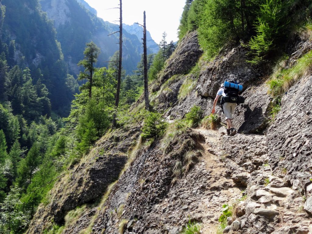
Busteni to Cabana Caraiman via Valea Jepilor – the Jepii Mici trail
Blue Cross Busteni – Cabana Caraiman (2025 m)
- ~3 hours, 5.5 km, 1281 m D+, 141 m D-
From Busteni, you will hike to the Bucegi plateau through the Valea Jepilor valley. This is a popular trail known as Jepii Mici.
The Jepii Mici Trailhead
The start of the Jepii Mici trail is 2 km away from the train station, at the end of Strada Telecabinei street.
It is marked with blue cross and it takes around 3 hours to complete. It ends at Cabana Caraiman (2025 m).
Cabana Caraiman is not open to the public.
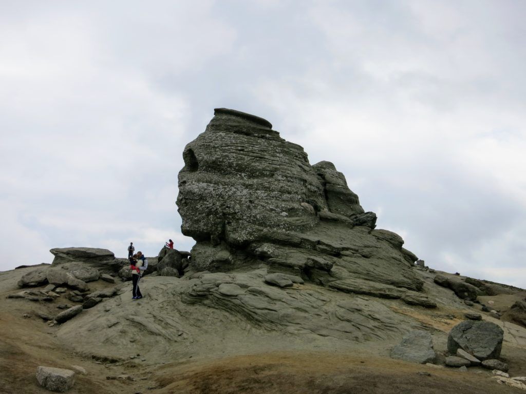
Cabana Caraiman to Cabana Babele
Blue Cross Cabana Caraiman (2025 m) – Cabana Babele (2200 m)
- ~30 minutes, 1.5 km, 185 m D+, 0 m D-
From Cabana Caraiman continue to follow the blue cross markings for about 30 minutes until you reach Cabana Babele.
Cabana Babele should be open during summer. They serve food and drinks but lately, it seems they do not offer accommodation.
Near the chalet, you will find the famous rock formations – The Sphinx and Babele (The Old Women).
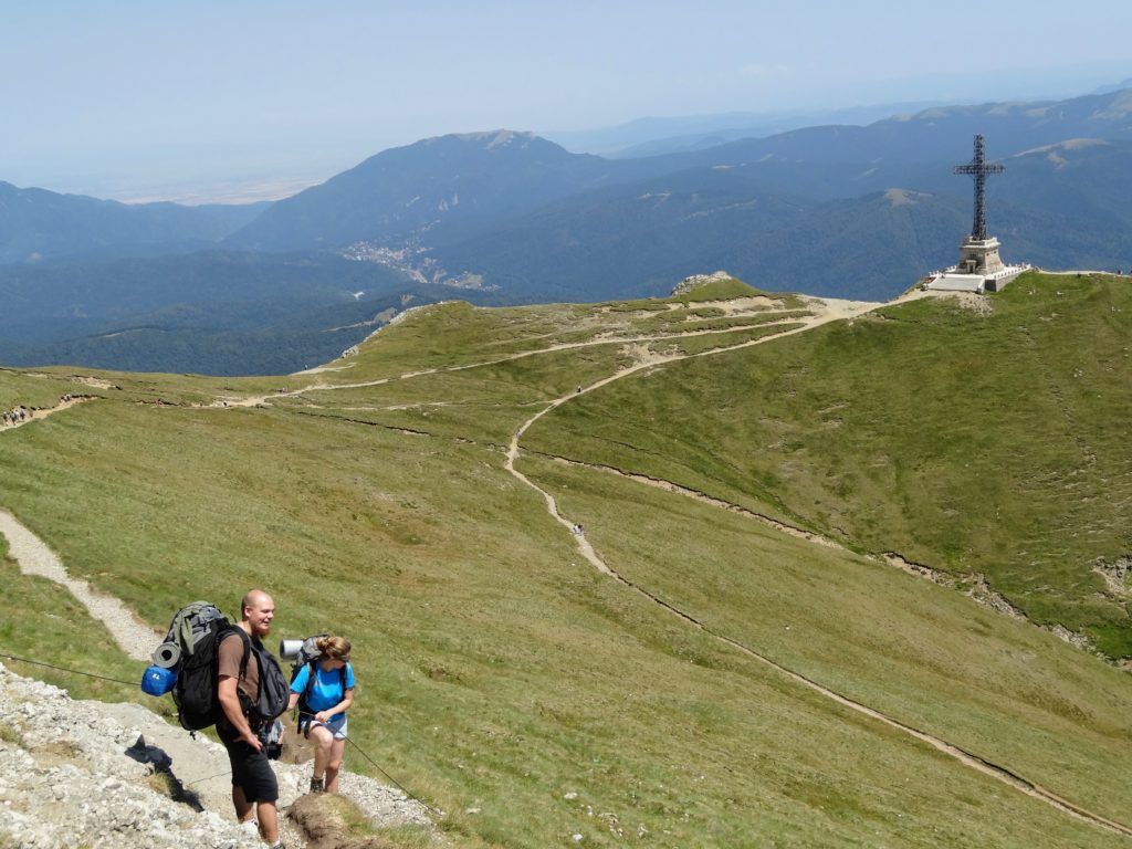
Cabana Babele to Crucea Caraiman
Red CrossCabana Babele (2200 m) – Crucea Caraiman(2291 m)
- ~1.5 hours, 3 km, 198 m D+, 111 m D-
From Cabana Babele continue on the red cross markings for around 1.5 h until you reach Crucea Eroilor de pe Caraiman (The Heroes’ Cross on the Caraiman Peak).
The monument was erected between 1926 and 1928 to commemorate the Romanian heroes of the First World War.
It was built at the altitude of 2291 m near Caraiman Peak, it has a total height of 36 meters, the cross itself has a height of 28 meters and two arms of 7 meters each.
In 2014, Crucea Caraiman entered the Guinness World Records as the tallest summit cross in the world located at such an altitude.
The views from the Heroes’ Cross over the town of Busteni and the Baiului Mountains are impressive.
Crucea Caraiman to Varful Omu Peak – the summit of Bucegi
Red Cross Crucea Caraiman(2291 m) – Saua Sugarilor saddle (2300 m)
Yellow Stripe Saua Sugarilor saddle (2300 m) – Varful Omu Peak (2505 m)
- ~2.5 hours, 6 km, 413 m D+, 207 m D-
From Crucea Caraiman follow the red cross markings towards Omu Peak until you intersect with the yellow stripe markings which will take you to the summit of Bucegi.
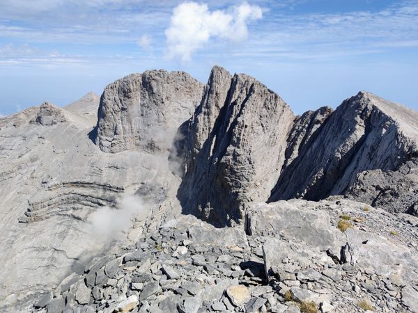
With the height of 2505 meters, Varful Omu is the highest peak in the Bucegi Mountains.
Cabana Omu
Cabana Omu was built on the summit and raises at 2507 meters.
Cabana Omu is usually open only during weekends and just in the summer season. They serve food and drinks, but if you want to rely on it for refueling, you’d better call first and make sure they are open and have supplies.
Cabana Omu phone number: +40744567290
If you climb on the top of the rock near Cabana Omu you will reach the altitude of 2514 m.
A few meters away from Cabana Omu there is a weather station which is functioning all year round. In case of an emergency, you can ask the personnel for help.
Omu Peak to Bucsoiu Peak
Red Stripe Varful Omu Peak (2505 m) – Varful Bucsoiu Peak (2492 m)
- ~40 minutes, 1.4 km, 110 m D+, 154 m D-
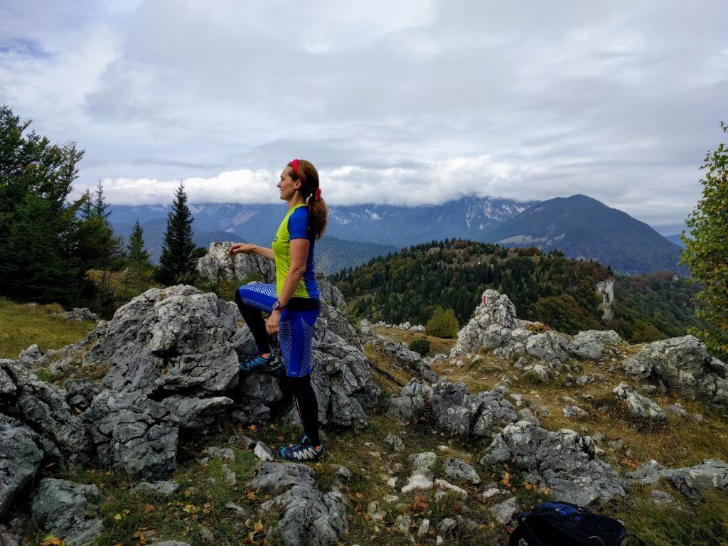
From Cabana Omu follow the red stripe markings to the Bucsoiu Peak. You will walk mostly on the Bucsoiu ridge which is narrow and spectacular.
Bucsoiu Peak
Bucsoiu Peak is 2492 meters high.
From Bucsoiu Peak you’ll have panoramic views over the towns of Azuga and Busteni at the East, Malaiesti Valley, Tiganesti ridge and Piatra Craiului Mountains at the West, Piatra Mare and Postavaru Mountains at the North.
Bucsoiu Peak to Malaiesti Valley via Brana Caprelor
Red Stripe then Blue Triangle Varful Bucsoiu Peak (2492 m) – Malaiesti Valley (1890 m)
- ~1.5 hours, 2.6 km, 113 m D+, 659 m D-
From Bucsoiu Peak continue on the red stripe markings until you reach the bifurcation towards Brana Caprelor. From there descend to the Malaiesti Valley by following the blue triangle markings.
Malaiesti Valley to Cabana Malaiesti
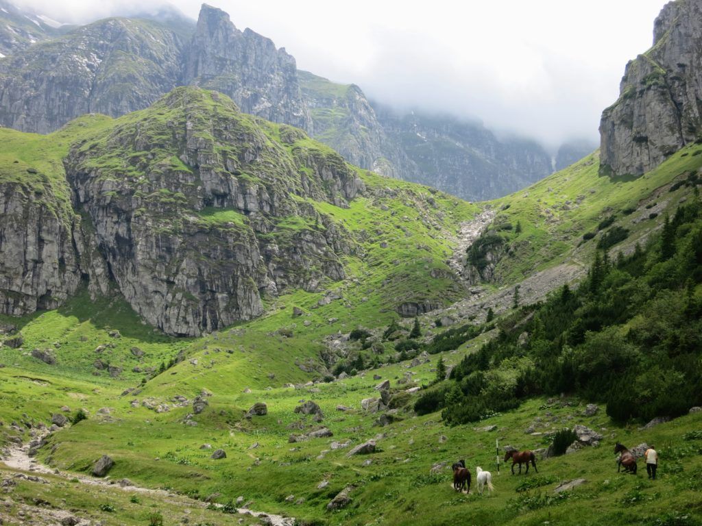
Blue Stripe Malaiesti Valley (1890 m) – Cabana Malaiesti (1720 m)
- ~30 minutes, 1 km, 0 m D+, 209 m D-
Once you reach the signpost in the Malaiesti Valley, descend by following the blue stripe markings until you reach Cabana Malaiesti , where you will spend the night.
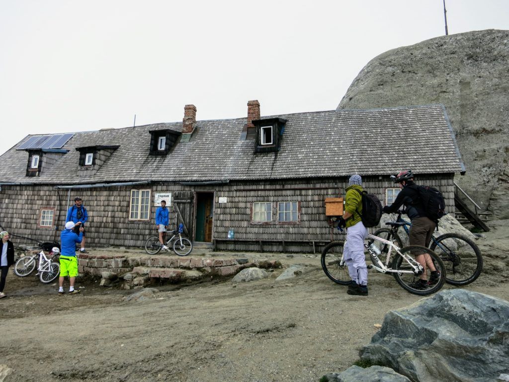
Cabana Malaiesti
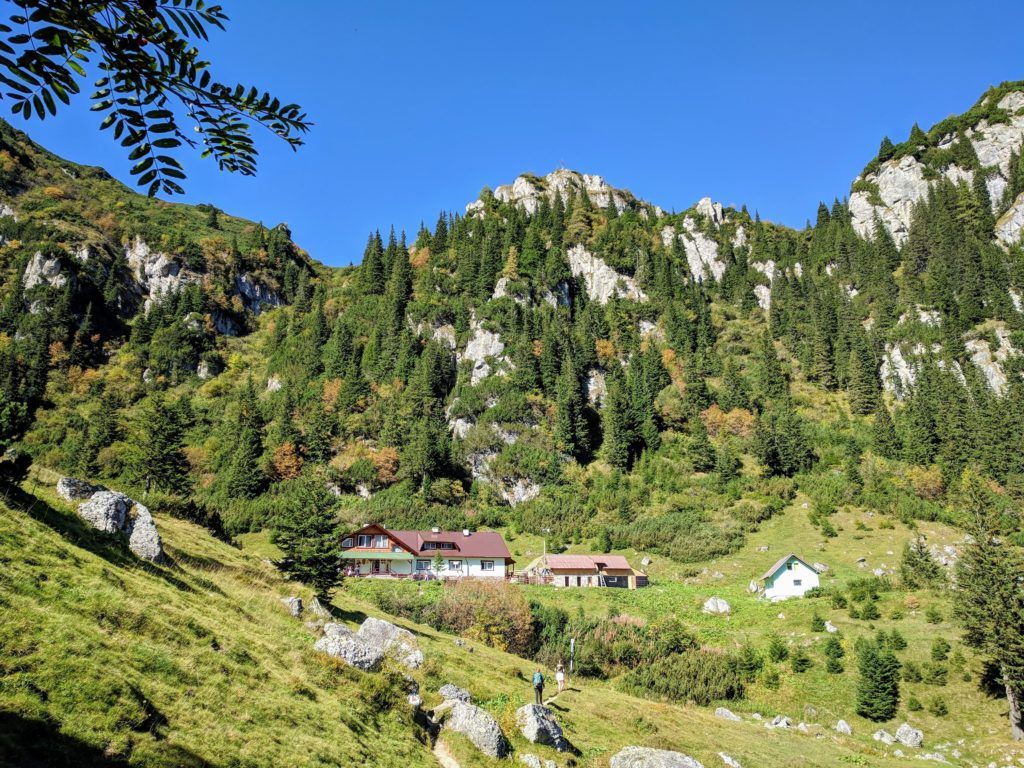
Cabana Malaiesti is located at 1720 meters altitude in a beautiful location, inaccessible by any modern means of transportation.
They serve food and drinks and the atmosphere at the hut is great during the weekends.
The facilities at Cabana Malaiesti are rudimentary, so make sure you know what to expect: you will be accommodated in a bunk bed with several other people in the room, there is no running water and the latrines are horrible.
Day 2 – Bran Castle and Magura village
ELEVATION PROFILE – DAY 2
- 10-12 hours of walking, 21 km, 1193 m elevation gain, 1868 m elevation loss
From Cabana Malaiesti descend to Bran, visit the Bran Castle and spend the night at a guest house in Magura or Pestera villages.
Make sure to ask if they serve food at the guest house you are booking otherwise you should get some supplies from Bran because you won’t find any shop in Magura.
Cabana Malaiesti to Tiganesti Ridge
Yellow Stripe then Varful Bucsoiu Peak (2492 m) – Malaiesti Valley (1890 m)
- ~2 hours, 3 km, 514 m D+, 20 m D-
From Cabana Malaiesti ascent to the Saua Tiganesti saddle by following the yellow stripe markings for about 2 hours until you reach Refugiul Tiganesti.
The path will be very steep at first, but after about 30 minutes the hike will become less strenuous as the trail starts to follow the contour lines up to the Tiganesti refuge.
On your way to the Tiganesti Saddle, where you will find a bivouac refuge, you will pass near the Tiganesti lake.
Tiganesti Refuge to Bran Castle
Blue Triangle then Varful Bucsoiu Peak (2492 m) – Malaiesti Valley (1890 m)
- 4 hours, 11 km, 20 m D+, 1435 m D-
From the Tiganesti refuge, start to descend on the red stripe markings for 7 km until you reach the cable car station in Bran at Zanoaga.
From there, continue on the asphalt road for 4 km until you reach the Bran Castle.
Visiting the Bran Castle
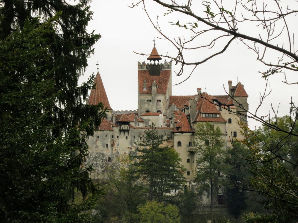
The last entry to Bran Castle is at 6 pm during the summer season. You can avoid the queues by purchasing tickets online from their website. It seems they ask you to print the tickets, so make sure you do this before getting to Bran.
Bran Castle to Magura Village
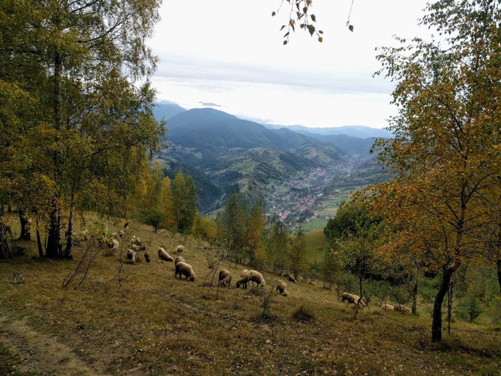
Red Stripe Bran to Magura Village
- 2.5 hours, 7 km, 637 m D+, 396 m D-
From the Bran Castle cross the road and find the small bridge with a signpost near it. Head towards Fantana lui Botorog by following the red stripe markings for about 2.5 hours until you reach the Magura Village.
Since the plan is to spend the night in Magura, depending on where your accommodation is, you may want to leave the marked trail at Varful Magura Mare and descend towards the village on the unmarked, but clear trails. We recommend using the maps.me app for navigation.
- This part of the trail is described in more detail here.
Day 3 – Magura village to Piatra Craiului ridge and Zarnesti
Elevation profile – day 3
- 10-12 hours of walking, 21 km, 1470 m elevation gain, 1610 m elevation loss
On the third day you will hike on the Northern Ridge of Piatra Craiului mountains and descend towards the town of Zarnesti.
Depending on your plans you can spend the night at Cabana Curmatura, at a guest house in the town of Zarnesti or even take the train from Zarnesti to Brasov if you still have time.
- You can find the schedule for the trains from Zarnesti to Brasov here.
Important: You will need to carry at least 2 liters of water per person for this hike. We recommend 3 liters. This hike is demanding and there is no water source on the Piatra Craiului ridge.
Magura village to Varful la Om – the summit of Piatra Craiului
Red Stripe Magura Village (1000 m) – Varful La Om (2238 m)
- 3 hours, 9 km, 1242 m D+, 61 m D-
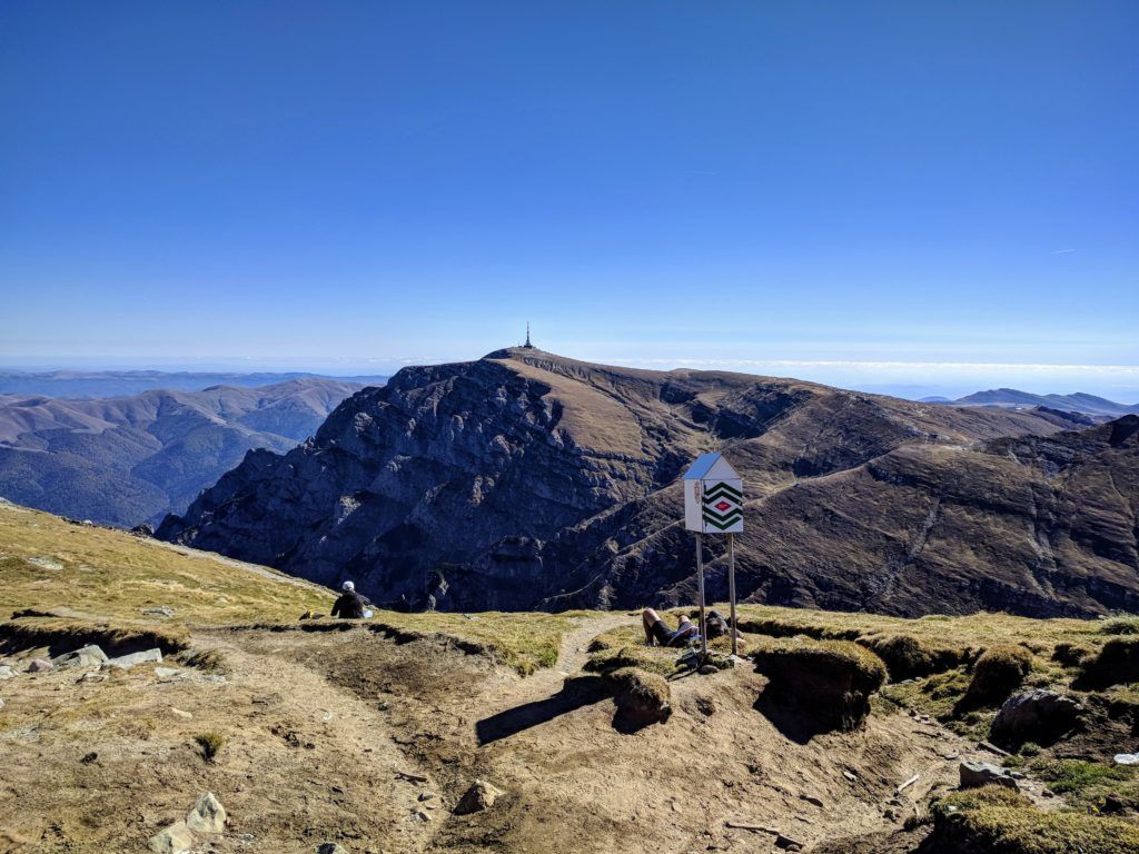
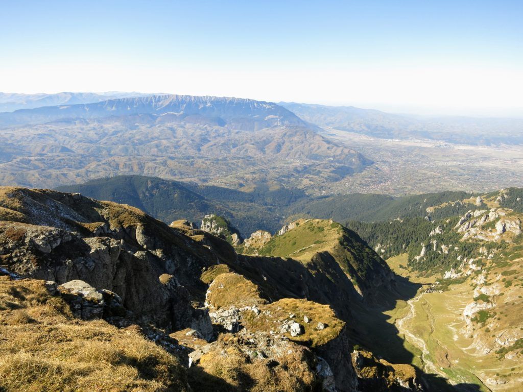
From Magura village find the red stripe markings and follow them until you reach Varful La Om at 2238 meters altitude. Varful la Om is the highest peak in the Piatra Craiului mountains.
On your way will get to Saua Joaca saddle, a place called La Table where you should find a water source (but it’s not reliable), and the Grind refuge.
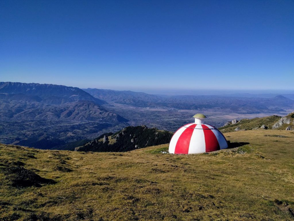
Near Varful La Om, in Saua Grindului saddle, there is another refuge (but you should walk on the ridge in the opposite direction, towards Varful Ascutit).
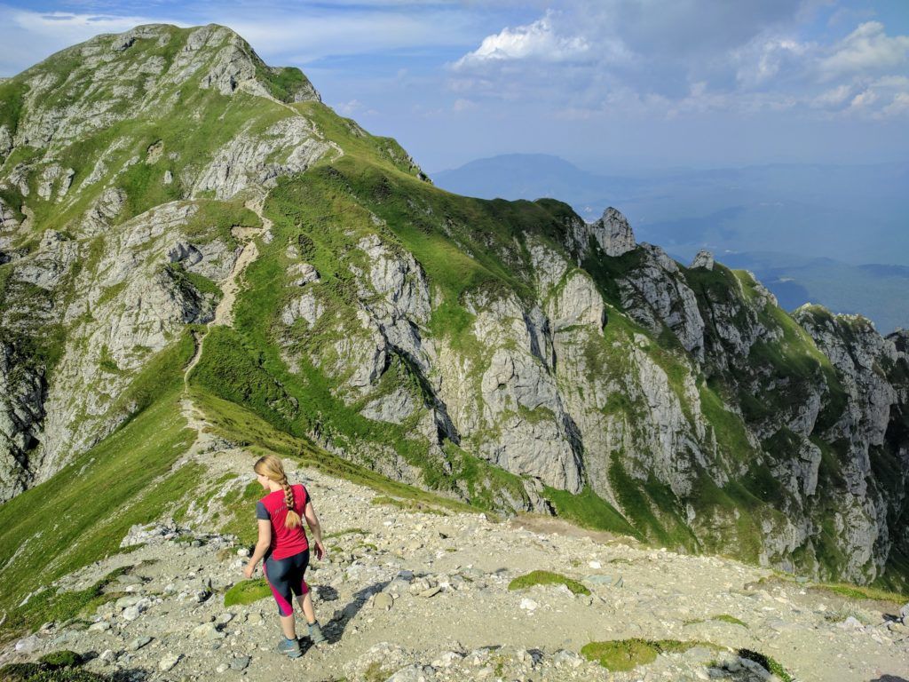
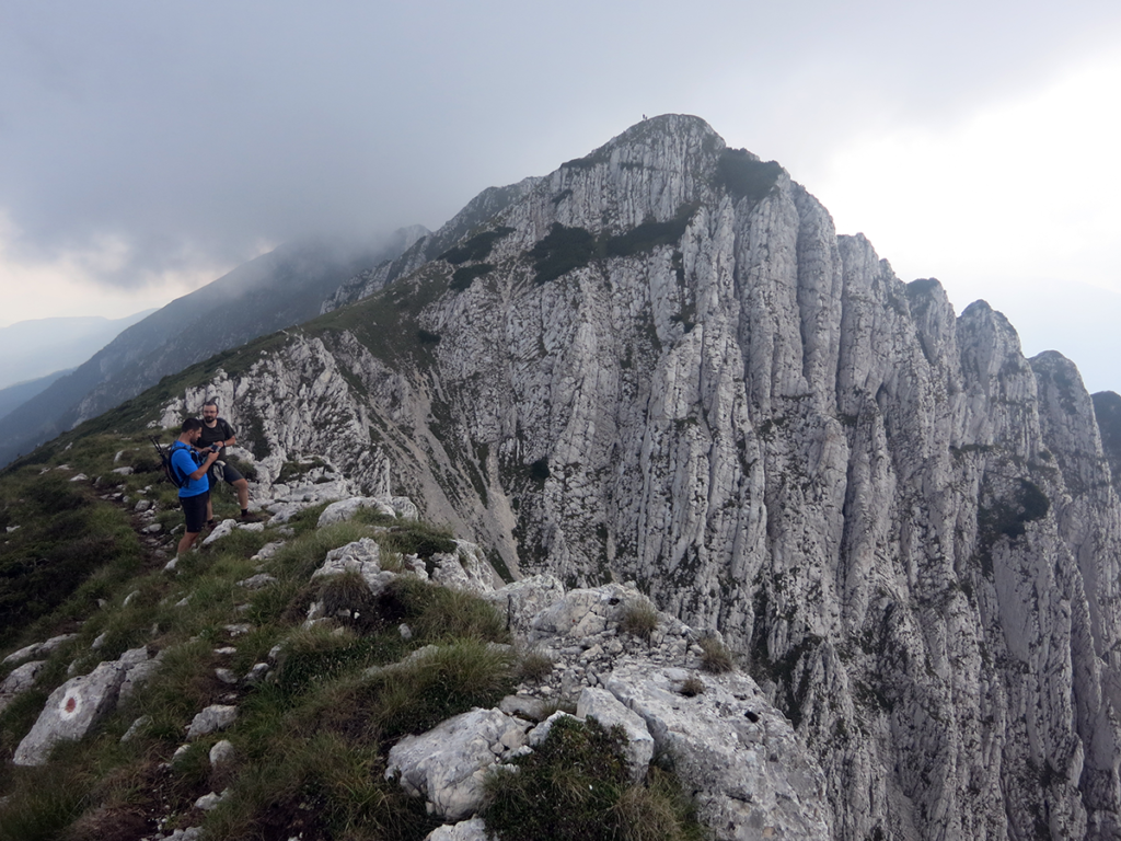
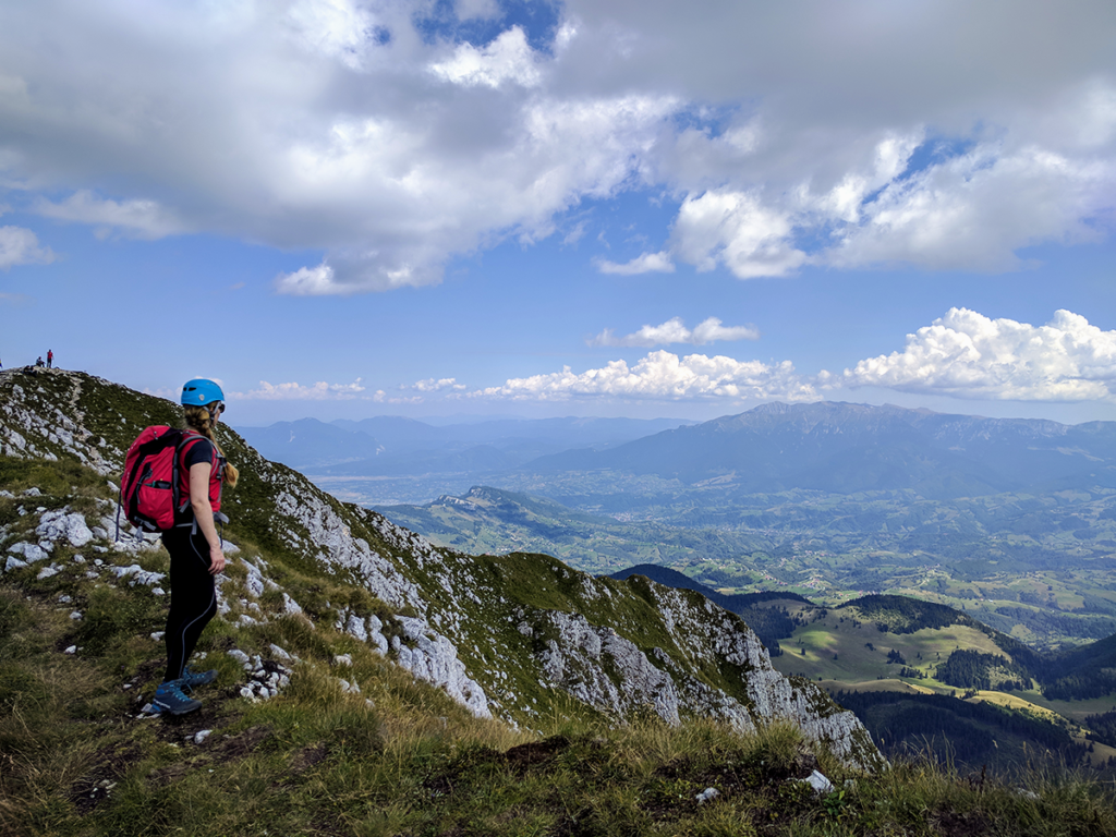
Varful La Om to Varful Ascutit – the Northern Ridge of Piatra Craiului
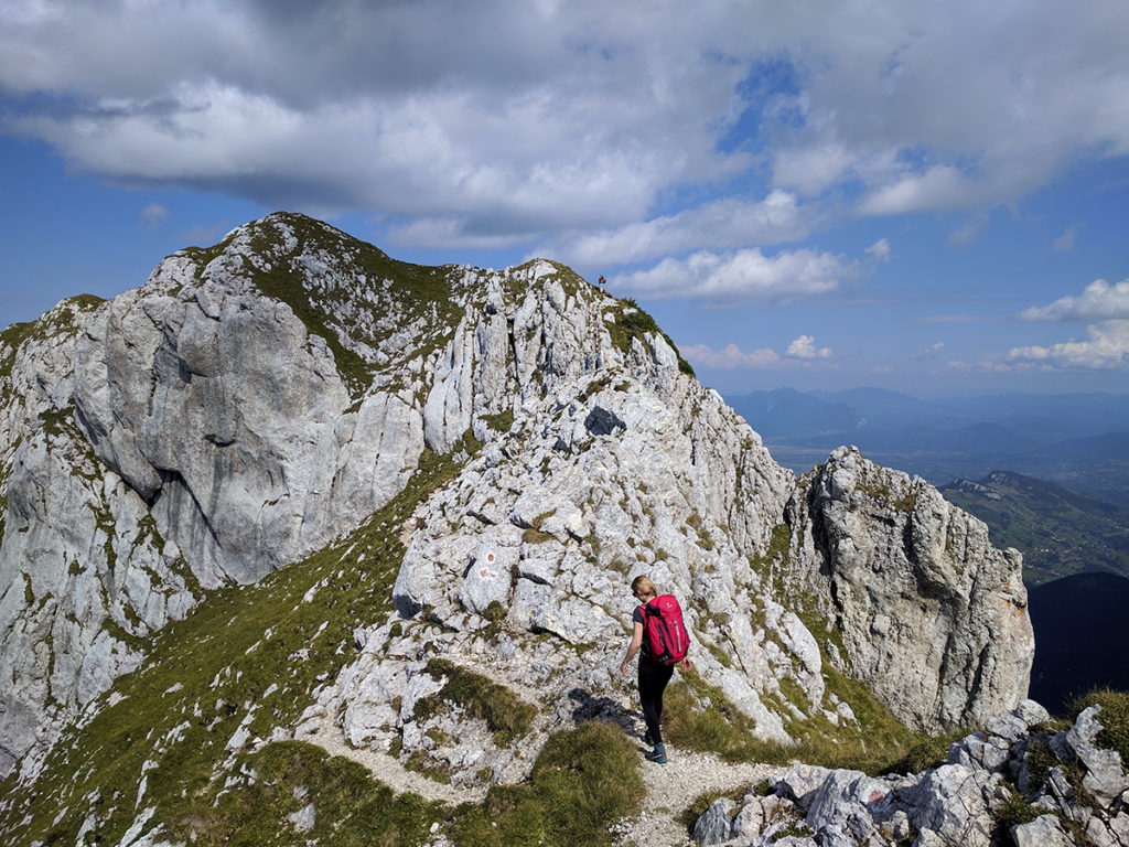
Red Disc Varful La Om (2238 m)- Varful Ascutit (2150 m)
- 3 hours, 3 km, 223 m D+, 315 m D-
Enjoy the views from Varful La Om and then continue on the Piatra Craiului ridge towards Varful Ascutit by following the red disc markings towards North.
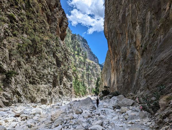
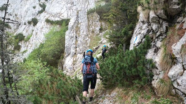
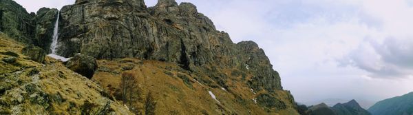
The Piatra Craiului ridge is narrow and rocky and the views are fantastic.
Note: Walking on the ridge involves some scrambling and it’s not recommended for the ones afraid of heights.
- We have described this part of the trail in more detail here.
Varful Ascutit to Cabana Curmatura
Blue triangle Varful Ascutit (2150 m) – Cabana Curmatura (1470 m)
- 2 hours, 2.6 km, 0 m D+, 684 m D-
From Varful Ascutit descent towards Cabana Curmatura via Padinile Frumoase, by following the blue triangle markings for 2.5 hours.
Cabana Curmatura
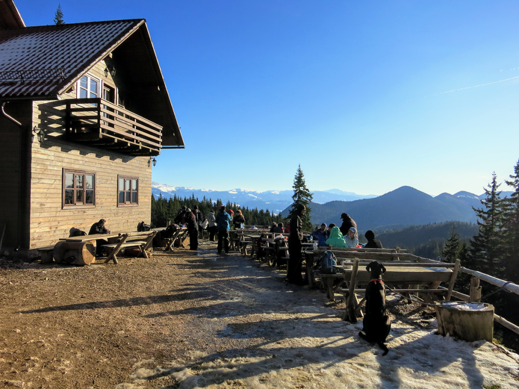
Cabana Curmatura is a nice chalet located in the mountains, at the altitude of 1470 meters.
At Cabana Curmatura they serve food and drinks and offer accommodation, however, they are always fully booked during the weekends.
Near the chalet there is a spring with drinkable water and a shower cabin with ice-cold water directly from the stream.
The toilets are located outside but are in a better condition than the ones at Cabana Malaiesti.
Cabana Curmatura to Fantana Lui Botorog
Yellow StripeCabana Curmatura (1470 m) – Fantana lui Botorog (850 m)
- 2 hours, 4.3 km, 37 m D+, 608 m D-
From Cabana Curmatura you can descend to Fantana lui Botorog by following the yellow stripe markings for 2 hours until you reach the spring at Fantana lui Botorog.
FANTANA LUI BOTOROG to Zarnesti train station
- 1 hour, 4.5 km, 18 m D+, 171 m D-
Fantana lui Botorog is located 2.5 km from the center of Zarnesti and 4.5 km from the train station in Zarnesti.
Zarnesti is 30 km away from the city of Brasov. The train ride from Zarnesti to Brasov takes around 30 minutes.
You can find the schedule for the trains from Zarnesti to Brasov here.