Hiking in Romania
With a third of the country’s surface covered by mountains, Romania offers some extremely beautiful hiking trails.
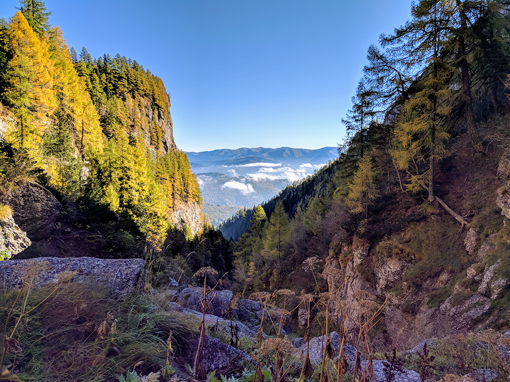
The Carpathians
The mountains in Romania are part of the Carpathian mountain range system, the second-longest in Europe, after the Scandinavian Mountains.
More than 50% of the entire 1500 km length of the Carpathians range stretches across Romania, covering a third of the country’s surface, surrounding the Transylvanian plateau.
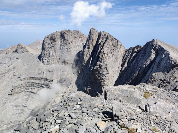
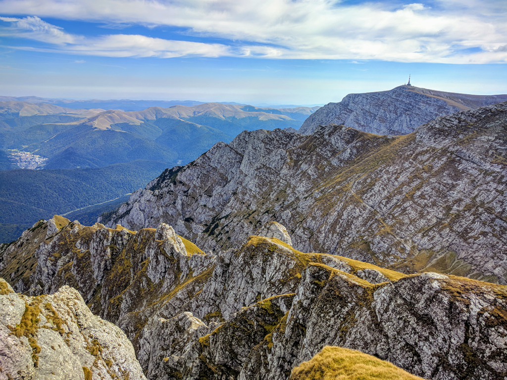
The Romanian Southern Carpathians, also known as the Transylvanian Alps, are the second-highest range in the Carpathians chain, after the Tatras, with 13 peaks exceeding 2500 meters.
The highest peak in Romania is Varful Moldoveanu (2544 m).
The highest range within the Carpathians are the Tatras, on the border of Slovakia and Poland with the highest peak being Gerlachovský (2655 m) in Slovakia.
Dobrogea

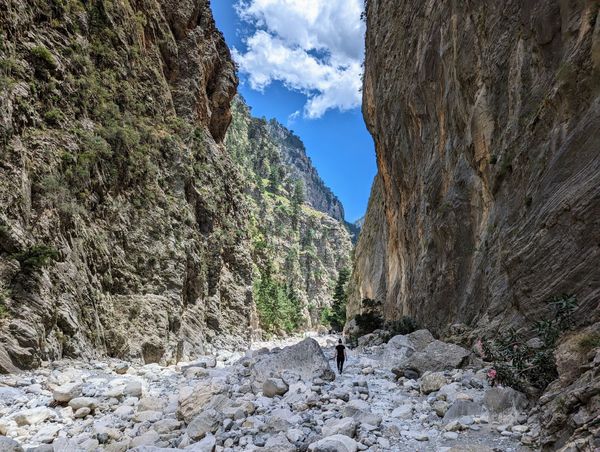
The Dobrogei Mountains with the surrounding wetlands are located in the south-eastern part of Romania.
The Macin Mountains are not tall mountains, the highest peak is Varful Tutuiatu (467 m) in Macin Mountains but the scenery is nonetheless spectacular.
The hiking trails in Romania
Considering their medium height, peaking at 2500 meters, the Romanian Carpathians are relatively easy to hike compared to the Alps, where you would need mountaineering skills and equipment in order to climb the highest peaks.
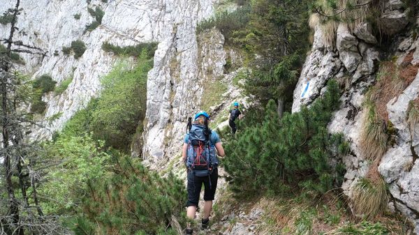
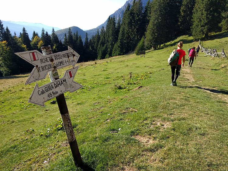
The marked hiking trails in the Romanian Carpathians do not require the assistance of a guide if you already have hiking experience.
You will find a good variety of trails, for all levels of experience and fitness. Some trails are easy, some are more demanding or even technical.
Since the mountains are so vast, you can spend an afternoon or even weeks hiking the Romanian mountains.
Some trails are not recommended during bad weather and some are closed during winter. Make sure you document well or ask the mountain rescue service before you start your hiking trip.
When to go hiking in Romania

The best time to visit Romania for hiking is from June until October. The days are longer and all the trails are open.
In general, the driest season for the Romanian Carpathians is from late August to early November.
In the months of June and July, thunderstorms usually take place around noon and last for around 2-3 hours.
The trails above 2000 m are usually covered in snow from late November until the end of May.
From January until late March, many trails above 1800 are closed due to avalanche risk.
Even if you may not be able to climb the highest peaks, there are many other mountains not taller than 2000 m you can safely hike during winter.
Equipment needed for hiking in Romania
You don’t need any special gear to hike the marked trails in Romania during summer. All you need is some good hiking shoes, a backpack and 3 layers of clothes (yes, even in the summer as it can get really cold above 1500 m).
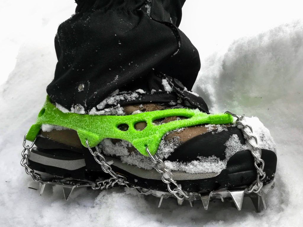
In winter it gets as cold as -20 degrees Celsius during the night, so you have to dress accordingly, in layers. Boots are a must otherwise, your feet may freeze.
If you want to go above 1800 m in winter, you may need crampons, snowshoes and an ice ax, depending on the snow conditions.
Many hiking trails above 1800 m are closed during winter because of the avalanche risk.
Maps of the hiking trails in Romania
Paper maps and digital maps
Having a paper map is always a good idea. It’s easier to see the whole picture on a paper map and serves as a good backup if your phone dies.
You can buy good paper maps of the Romanian mountains from muntii-nostri.ro. The trails are described in both Romanian and English and show the track profile. You can also study the maps and the trails on their website and download the kmz and gpx tracks.
Zenithmaps.com also sell paper maps and have a good mobile app.
Shops that sell paper maps
You can also find paper maps in the large book stores and the shops that sell mountain equipment in the main cities of Romania.
The best places to go hiking in Romania
We already described in detail some of our hiking trails here.
In short, the closest mountains to each city or region:
- Bucharest: Bucegi Mountains, Baiului Mountains and Piatra Craiului Mountains
- Brasov, Rasnov and Bran Castle: Piatra Mare Mountains, Bucegi Mountains, Piatra Craiului Mountains, Ciucas Mountains
- Sibiu, Ramnicu Valcea: Fagaras Mountains, Cozia Mountains, Buila-Vanturarita Mountains, Parang Mountains
- Timisoara, Deva, Hunedoara: Retezat Mountains, Apuseni Mountains
- Cluj Napoca and Oradea: Apuseni Mountains, Cheile Turzii (Turda Gorge)
- Baia Mare (N-V of Romania): Maramures mountains, Valea Izei (Iza Valley)
- Bucovina (N-E of Romania), Iasi: Ceahlau Mountains
- Dobrogea (S-E of Romania): Constanta: Macin Mountains
Bucegi Natural Park
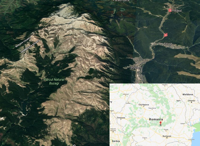
Bucegi Mountains are perfect for both short and long hiking trips. They offer breathtaking scenery and a good variety of hiking trails for both beginners and advanced.
From Bucharest you can get to their base, the town of Busteni, in 2 hours, either by train or by car.
The hiking trails in Bucegi are well maintained and the markings are in good condition.
There are several chalets high in the mountains where you can spend the night or have a warm meal.
The highest peak is Varful Omu (2505 m) to which you can get in 6-8 hours on many different and spectacular trails from the base of the mountain.
The eastern side of the Bucegi Massif, near Cabana Babele, is more popular among tourists and gets crowded during the weekends. This is due to the fact that it has a lot of infrastructure (cablecar, roads).
However, the other parts of the Bucegi Mountains are even more spectacular and peaceful.
If you want to discover the wilder, less beaten parts of the Bucegi Massif check out our favorite hiking trails in Bucegi Mountains.
- Read a more detailed description of the hiking trails Bucegi Massif
- The list of our favorite hiking trails in Bucegi Mountains
Piatra Craiul National Park
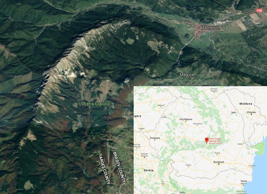
Piatra Craiului is a spectacular mountain range, located 30 minutes away from Brasov and 3 hours away from Bucharest. They offer a mix of easy, moderate and difficult trails, with great scenery.
Stretching for about 25 km from north to south at around 2000 meters, the Piatra Craiului ridge is sharp, jagged and rocky and literally breathtaking.
The summit of Piatra Craiului is Varful La Om (2238 m). It is also known as Piscul Baciului.
An incredible experience would be to spend the night right on top of the ridge in one of the two bivouac refuges located above 2000 meters, near Varful La Om or Varful Ascutit.
Magura and Pestera villages
At the eastern side of Piatra Craiului mountains, at an altitude of 1000 meters, lay the authentic mountain villages of Magura and Pestera, located in a magical and picturesque place with beautiful views over the Piatra Craiului ridge.
From the villages of Magura and Pestera you can take shorter or longer walks that are suitable for any type of fitness level and experience.
You will find many rustic guest houses in the Pestera and Magura villages that offer accommodation.
Plaiul Foii
Other accommodation options are at the west of the Piatra Craiului Massif, at Plaiul Foii.
Many beautiful hiking trails start from Plaiul Foii, including one of the most spectacular and technical hiking trails in Romania that will get you on top of Piatra Craiului Ridge, at Varful La Om (2238 m).
Cabana Curmatura
The only hut located in Piatra Craiului National Park is Cabana Curmatura, at an altitude of 1427 meters.
You can get to Cabana Curmatura in a 2-3 hours walk from the start of the trail, at Botorog’s Fountain, 4 km away from the town of Zarnesti.
If you want to spend the night at Curmatura Chalet, make sure you book weeks in advance because they are very crowded during the weekends.
Fagaras Mountains
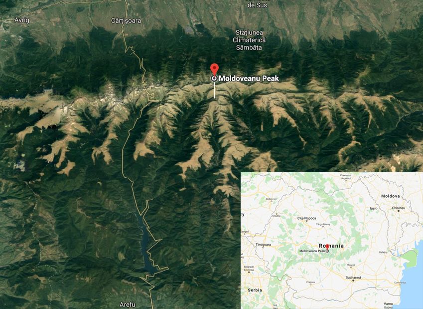
Fagaras Mountains are the highest in Romania with many peaks above 2000 meters. They are also the biggest, with a length of 70 km and a width of 40 km. Moldoveanu Peak is the highest (2545 m) followed by Negoiu Peak (2535 m).
Sibiu is the closest city to Fagaras Mountains.
Varful Moldoveanu – the summit (2454 m)
One of the trails towards the Moldoveanu summit starts near Complex Turistic Sambata de Sus, 1-hour drive from Sibiu.
It’s a 36 km hike that you can split over 2 or even 3 days. You can spend the night at Cabana Sambata and on the main ridge at Fereastra Mica bivouac refuge (in autumn 2018 the door was missing!) or at Vistea Mare refuge (right at the foot of Moldoveanu Peak)
Varful Negoiu – the second highest (2535 m)
The second highest peak in Fagaras Mountains is Negoiu Peak (2535 m).
The start of our favorite trail is at Poiana Neamtului guest house near the town of Avrig from where you can reach Negoiu Peak in about 8.5 hours.
You can stop at Cabana Barcaciu hut and Cabana Negoiu chalet along the way.
Hiking the entire ridge of the Fagaras Mountains (100 km)
Hiking the entire length of the Fagaras Mountains main ridge, from Turnu Rosu to Plaiul Foii, requires a good amount of effort and can take from 3 days up to one week to complete.
The accumulated level difference is somewhere around 6000 m with a total distance of about 100 km.
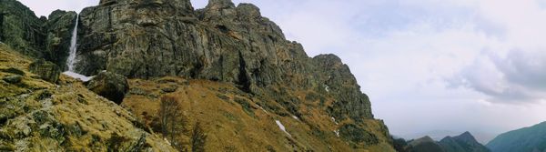
Urlea glacial lake and Dara Peak
Some of the most picturesque places, like Urlea glacial lake and Dara Peak, are not found along the main ridge. You can do this amazing 2-day hiking trip by spending the night near the Urlea glacial lake in the bivouac refuge.
Retezat National Park
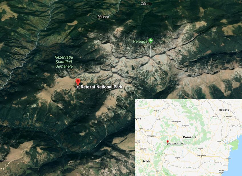
Retezat Mountains offer some of the best scenery in Romania, with high peaks, moraines and an impressive number of glacial lakes.
Retezat National Park is located in the western part of Romania, close to Sibiu, Timisoara, Hunedoara and Deva.
Timisoara is the largest city in the West of Romania. Deva is a smaller town guarded by an impressive citadel on top of a volcanic hill. In Huneodoara you can visit the famous medieval Hunyadi castle.
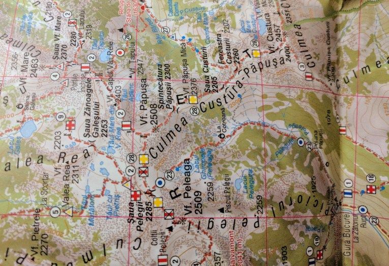
In Retezat National Park you will find a huge number of glacial lakes and 2 of the 13 peaks above 2500 m in Romania, Peleaga (2509) and Papusa (2508 m).
You can start hiking the mountains from the village of Cârnic. It is a 3 hours drive from Timisoara and 1 hour from Deva and Hunedoara.
From the free parking place in Cârnic, you can reach Cabana Gentiana in 2-3 hours. You can also find accommodation in Cârnic.
- Read about our first hiking trip in Retezat National Park
Ciucas Mountains
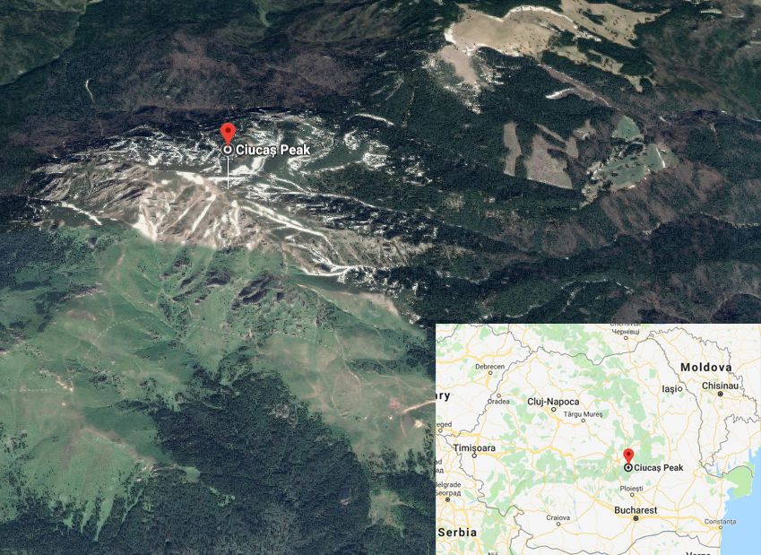
The highest peak in the Ciucas Mountains is Varful Ciucas (1954 m).
The most popular hiking trails in the Ciucas Mountains start from the village of Cheia, which is located 1 hour away from Brasov and 2-3 hours away from Bucharest by car.
With a 4×4 car, you can drive all the way to Cabana Ciucas chalet (1595 m). It has a restaurant and hotel-like facilities.
- Read about a one day winter hike in Ciucas Mountains
Baiului Mountains
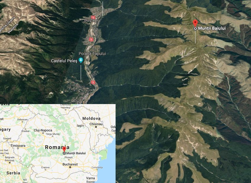
Baiului mountains are located 2 hours away from Bucharest and are accessible by train and by car.
Less high than Bucegi Mountains, stretching for about 20 km between the towns of Azuga and Sinaia, Baiului Mountains offer great views over Bucegi Mountains.
The trails are easy. The highest peak is Varful Neamtu (1923 m).
- Read about a beautiful winter hike in Baiului Mountains